The AurMac Gold Project (the “Project” or the “Property”) is located in the Mayo Mining district, approximately 40 kilometres (“km”) northeast from the village of Mayo and 356 km north of Whitehorse, within the traditional territory of the First Nation of Na-Cho Nyak Dun. The AurMac Gold Project consists of the Aurex and McQuesten projects optioned from Victoria Gold Corp. and Hecla Mining Company, respectively, as well as additional claims staked by Banyan Gold Corp. (the “Company” or “Banyan”). With the optioned claim blocks and additional staking completed by Banyan, the AurMac Property currently covers over 720 km2. Banyan has earned 100% of the Aurex and McQuesten Properties subject to royalties (refer to news release dated September 18, 2025). The projects are road accessible through the Silver Trail highway and a network of four-wheel drive roads and trails.
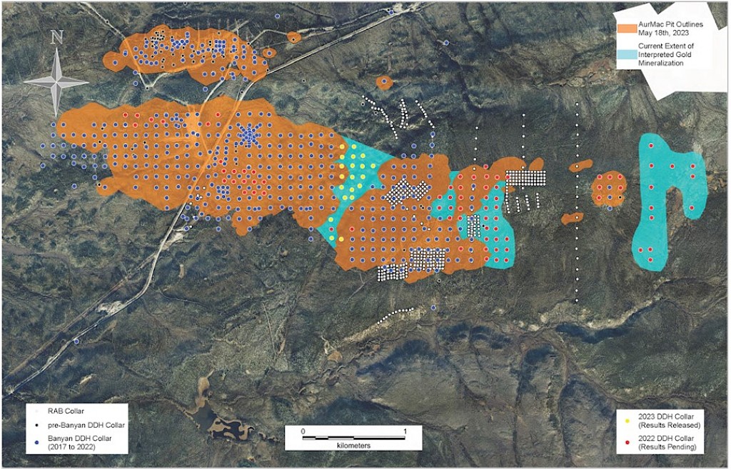
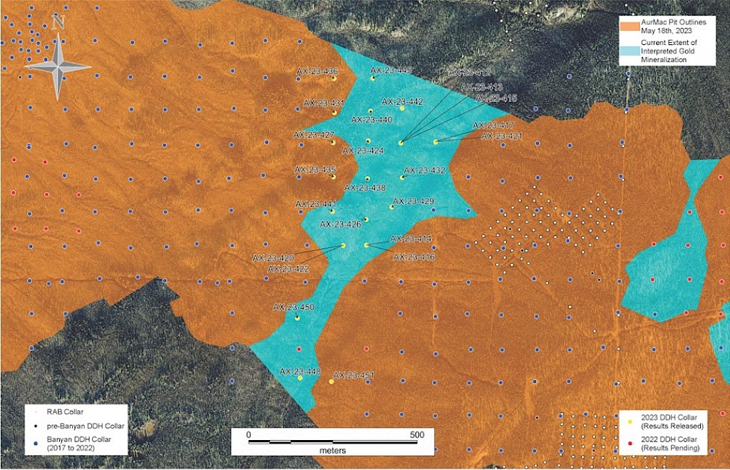
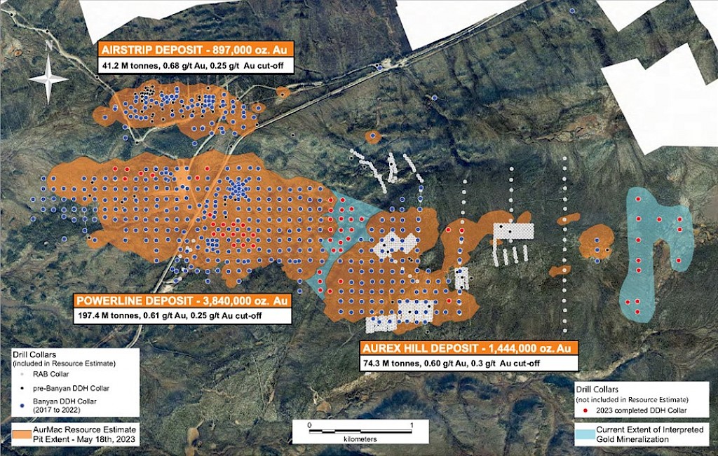
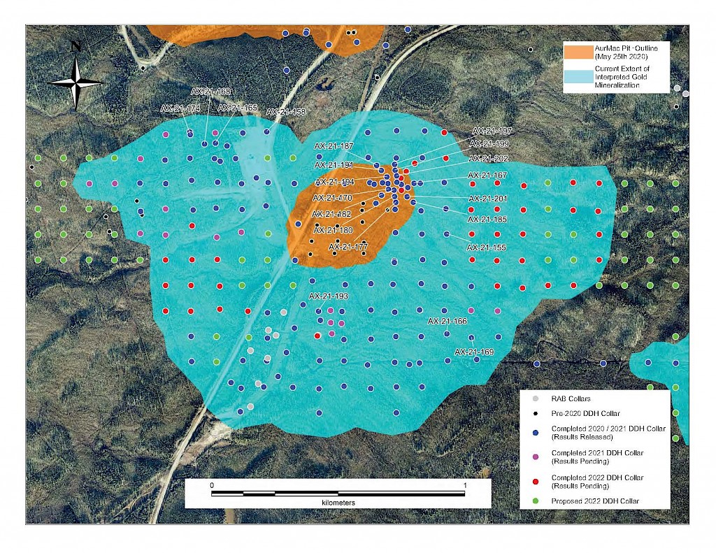
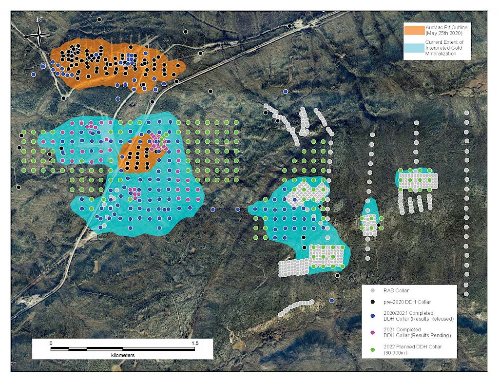
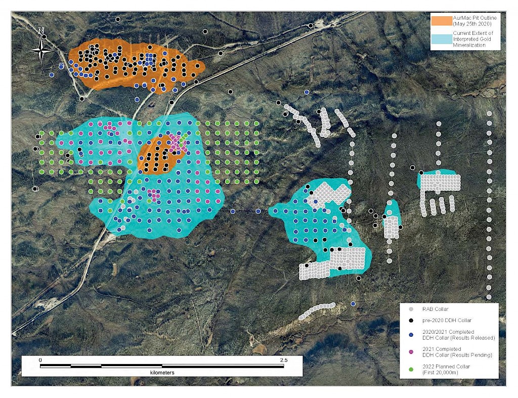
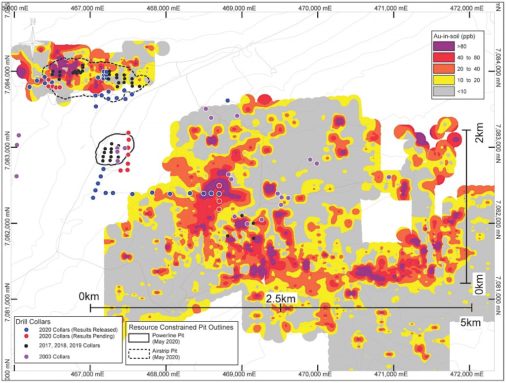
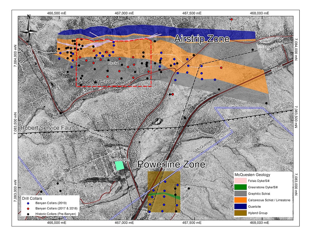
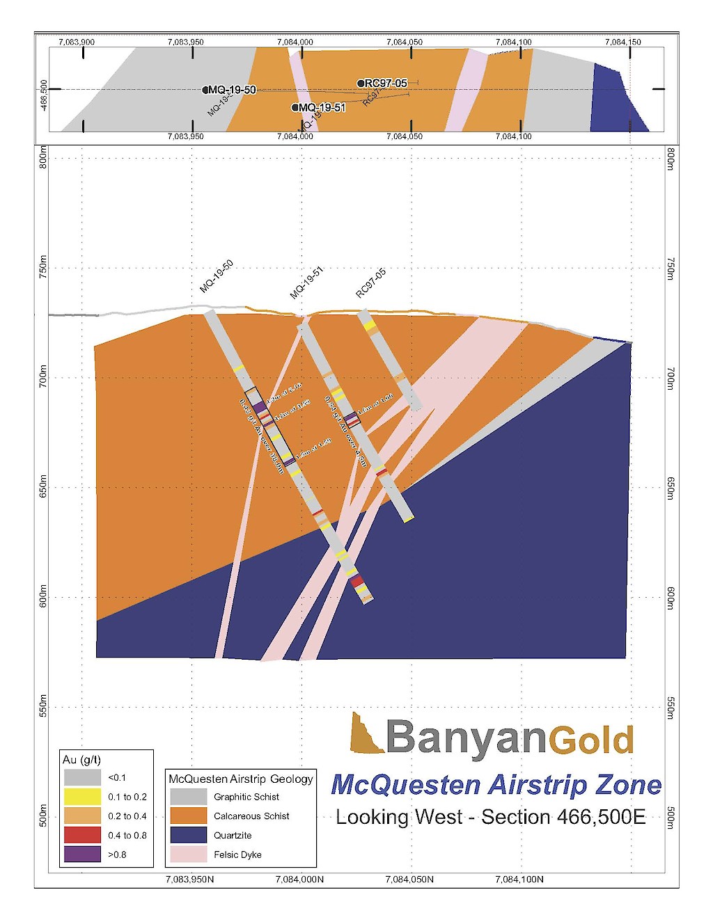
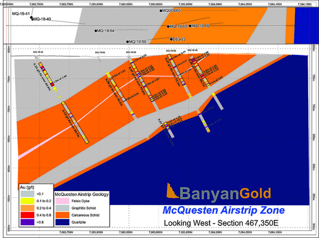
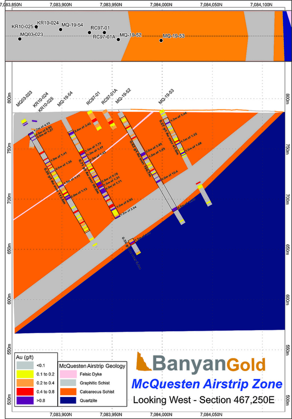
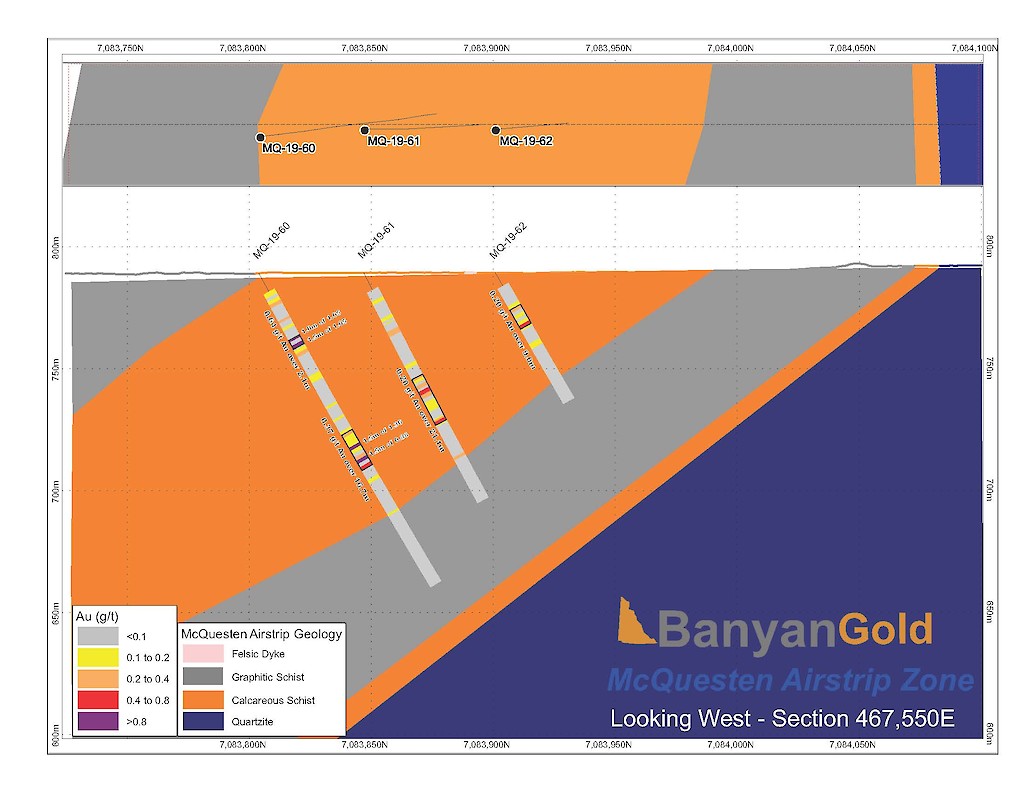
A new Mineral Resource Estimate (“MRE” or “Mineral Resource”) was issued in accordance with National Instrument 43-101, Standards for Disclosure for Mineral Projects (“NI 43-101”) for the AurMac Property comprised of a total inferred mineral resource of 4.985 Million ounces of gold at 0.58 g/t Au and total indicated mineral resource of 3.639 Million ounces at 0.68 g/t . This resource is located in located in two zones, the Airstrip and Powerline zones, is open in all directions and at depth, and has the potential for further expansion.
Table 1: Pit-Constrained Inferred and Indicated Mineral Resources – AurMac Project(1)(2)(3)(4)(5)
|
Indicated MRE |
Inferred MRE |
||||||
|
Deposit |
Au Cut-Off Grade (g/t) |
Tonnage (M Tonnes) |
Gold Grade (g/t) |
Gold Content (M Oz) |
Tonnage (M Tonnes) |
Gold Grade (g/t) |
Gold Content (M oz) |
|
Airstrip |
0.30 |
37.7 |
0.69 |
0.840 |
15.1 |
0.84 |
0.405 |
|
Powerline |
0.30 |
129.5 |
0.67 |
2.799 |
270.4 |
0.57 |
4.580 |
|
Total Combined |
0.30 |
167.3 |
0.68 |
3.639 |
267.2 |
0.58 |
4.985 |
Notes to Table 1:
Banyan Gold Corp. also holds the Nitra claim block located 10 km west of the AurMac Project which has potential to host similar gold mineralization to AurMac and is currently being explored.
INTERACTIVE 3D MODEL AND TOUR: AurMac Project
The AurMac Gold Project has a rich history of exploration and mining dating back to the beginning of the 1900’s. Historically, the area nearby at Keno and Galena Hill has been subject to intense silver exploration, development, and mining. The earliest prospecting activity for gold began as early as 1898, shortly after the Klondike gold rush.
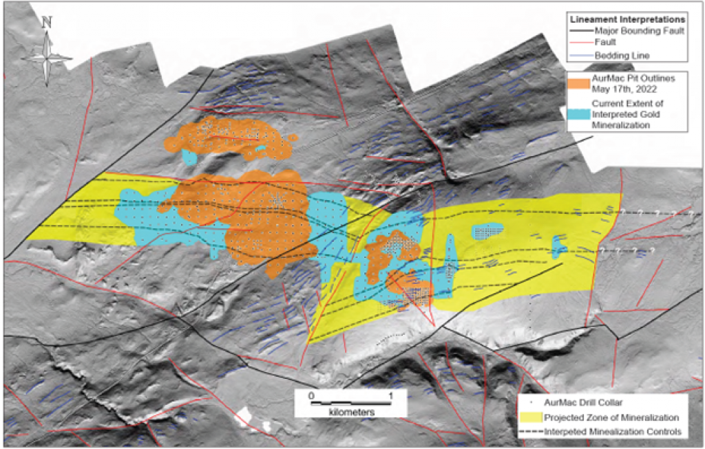
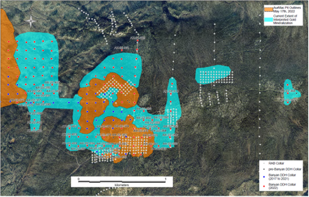
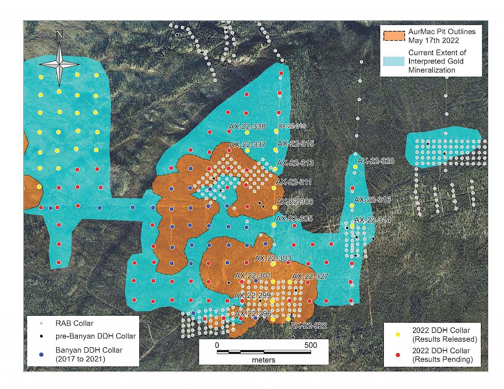
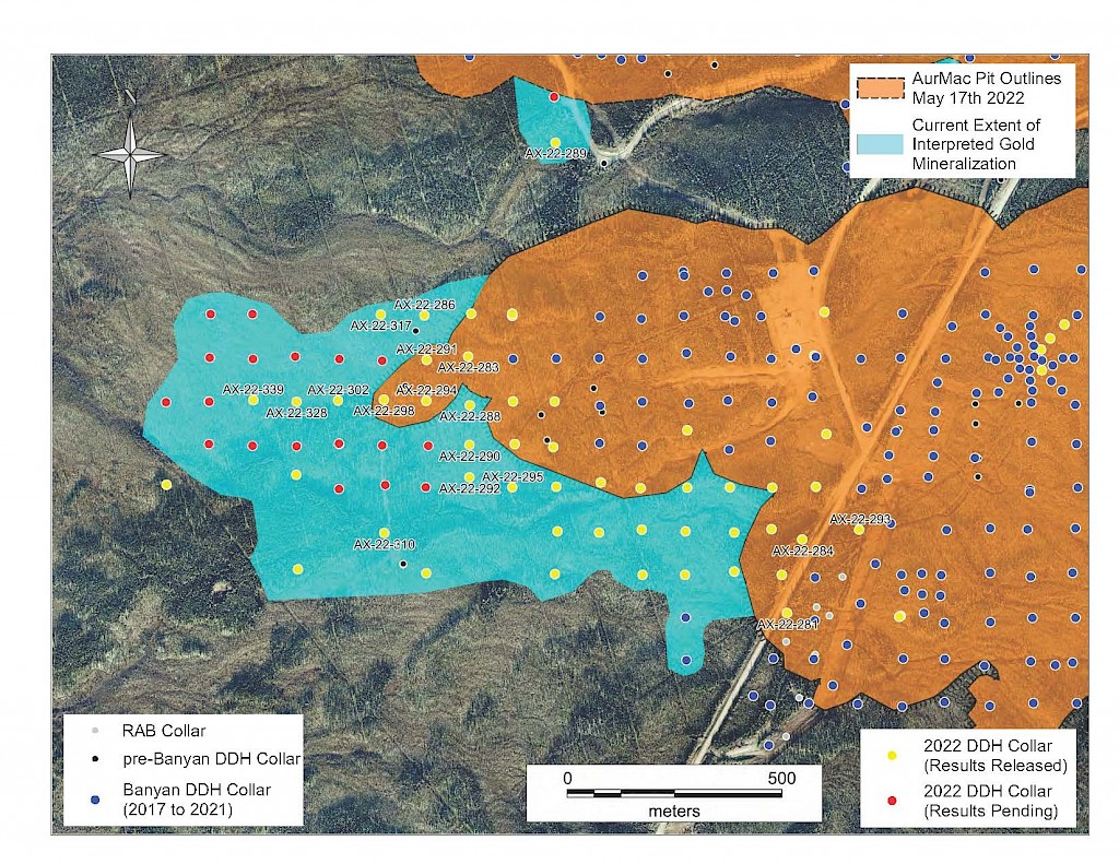
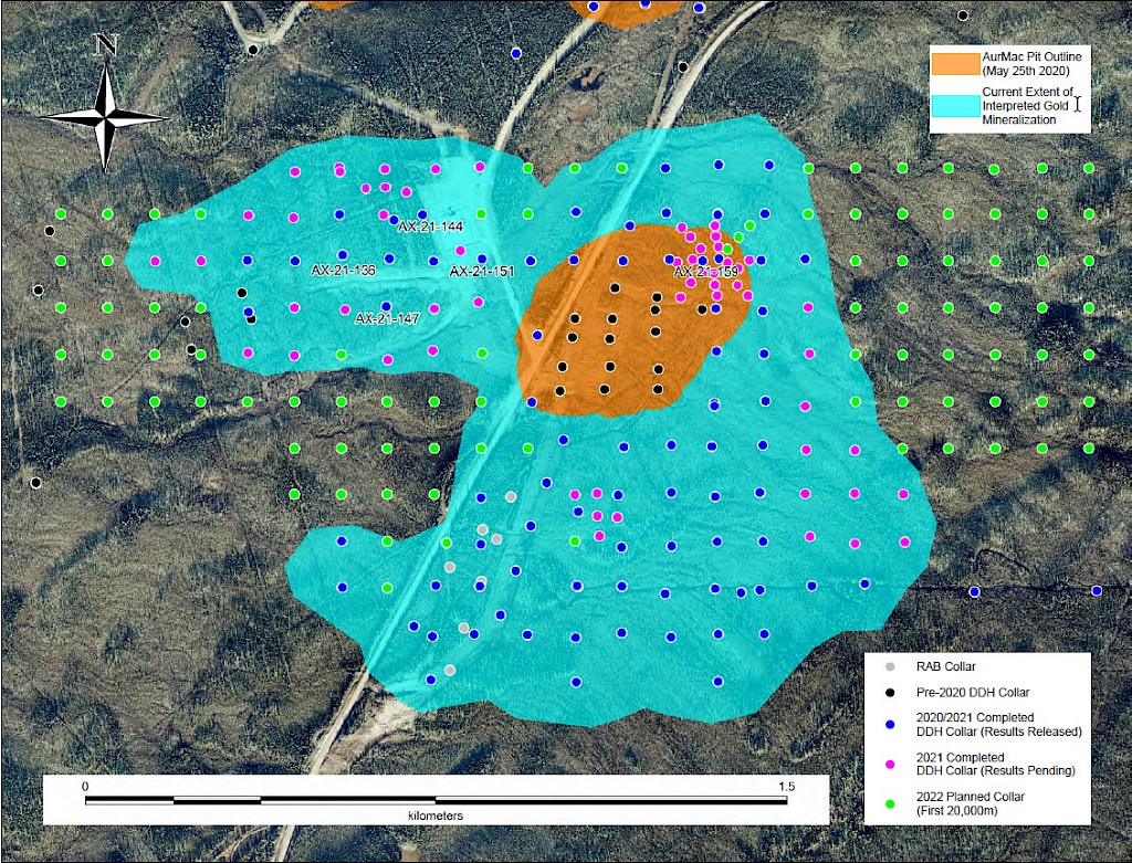
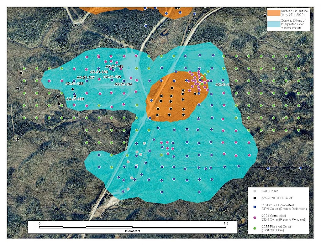
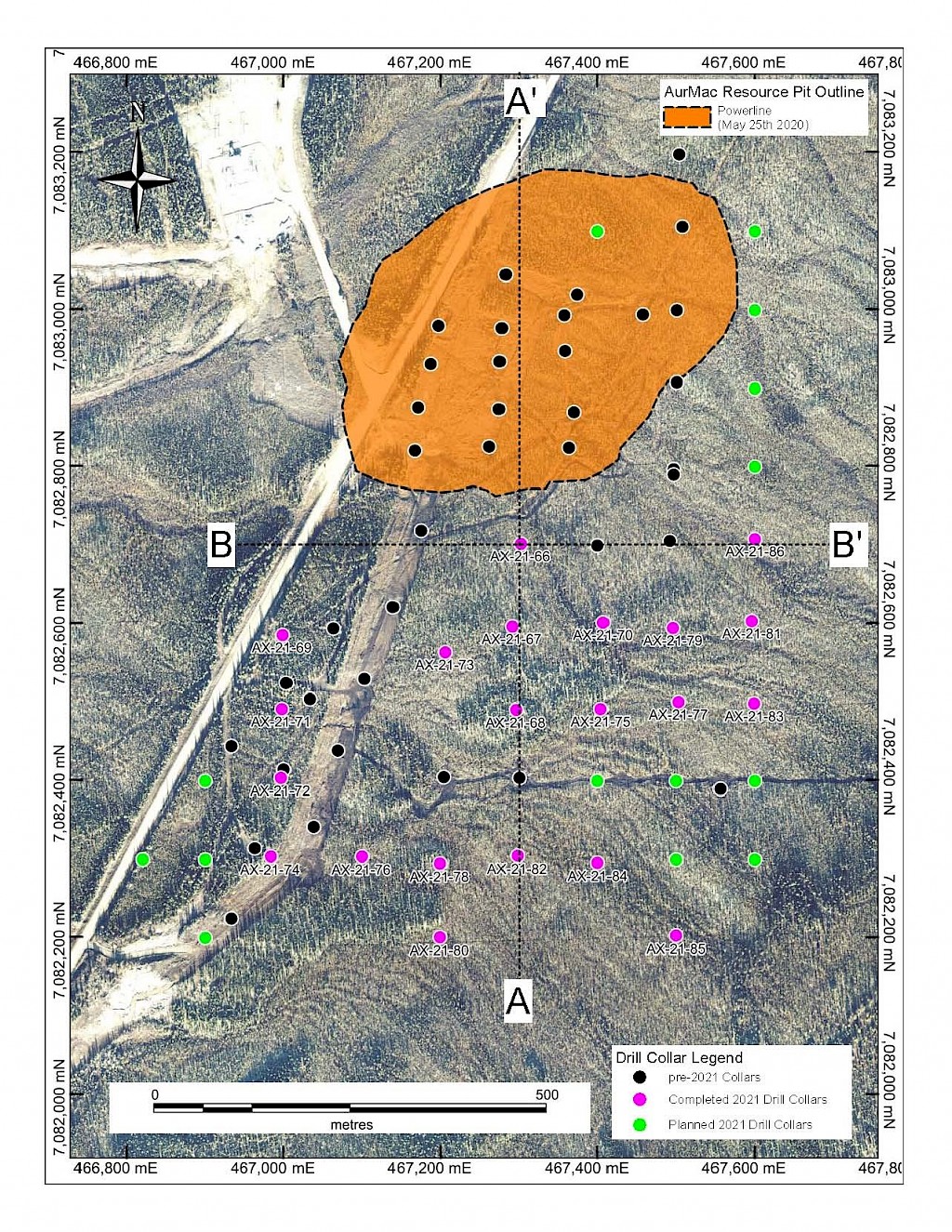
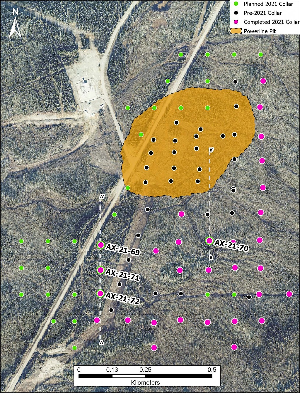
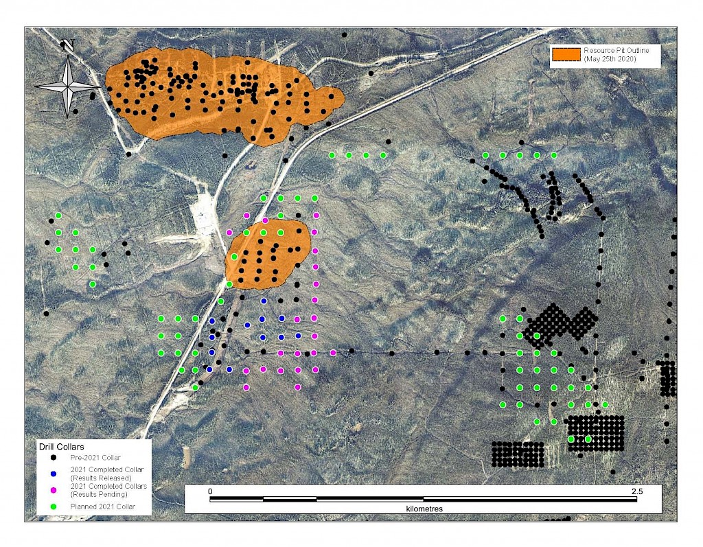
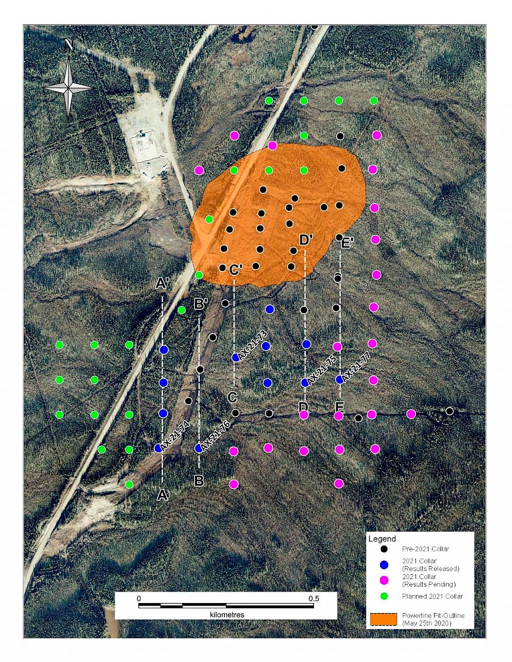
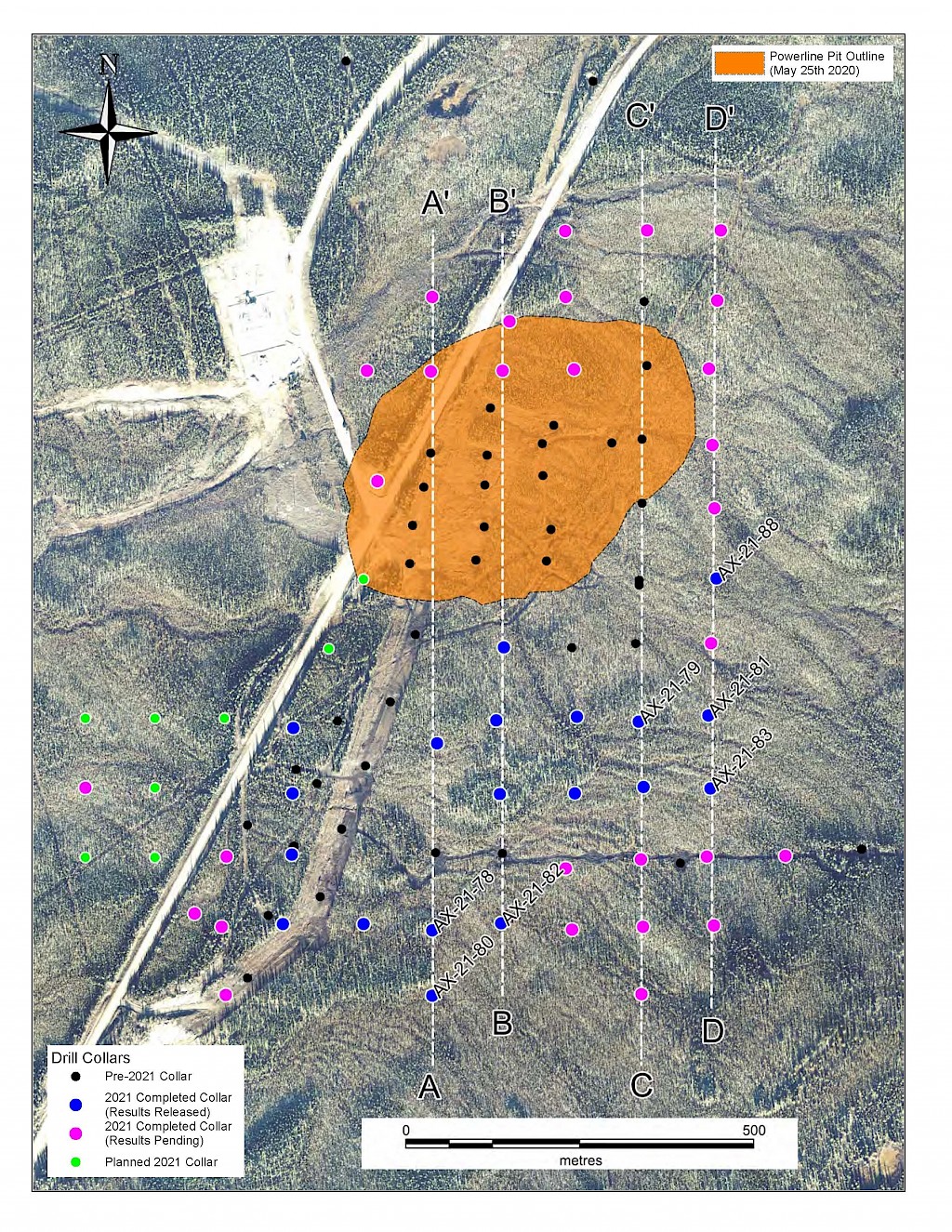
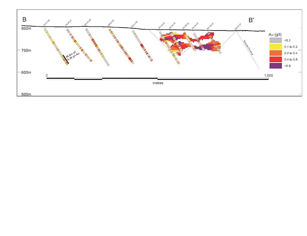
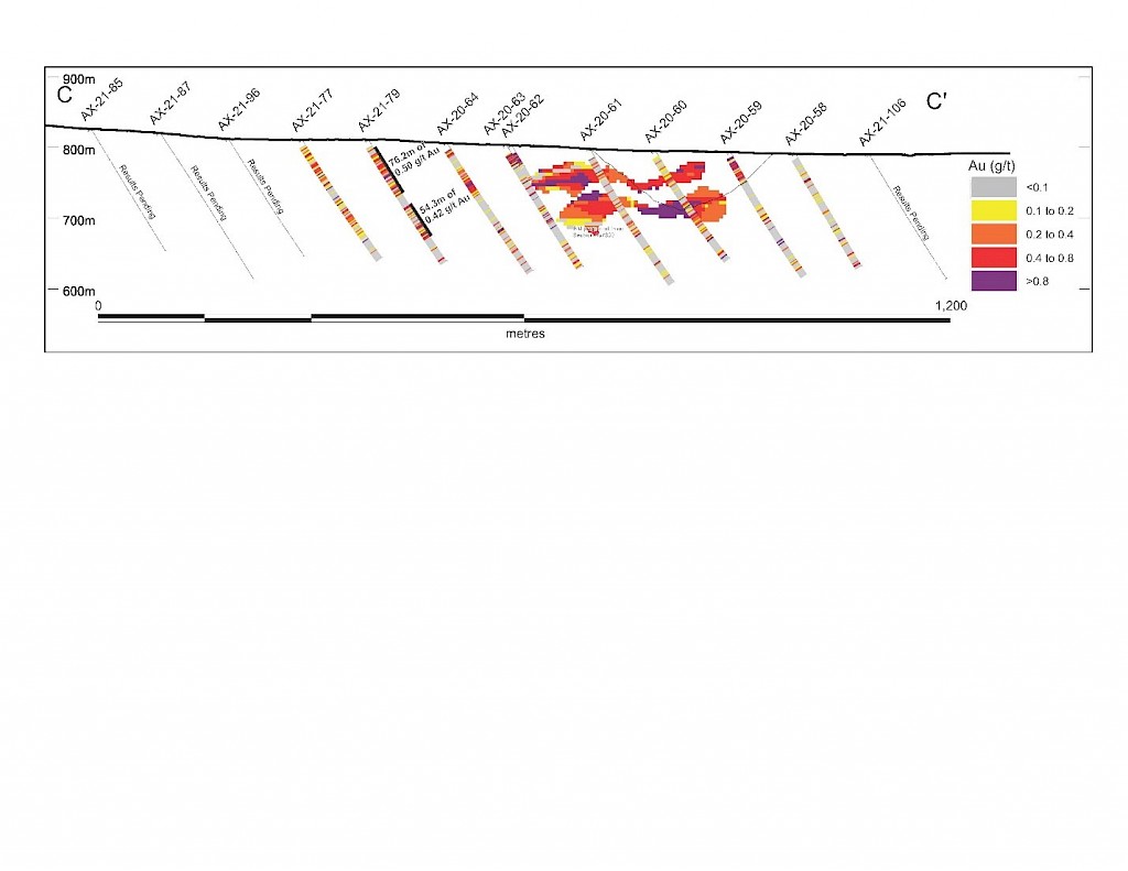
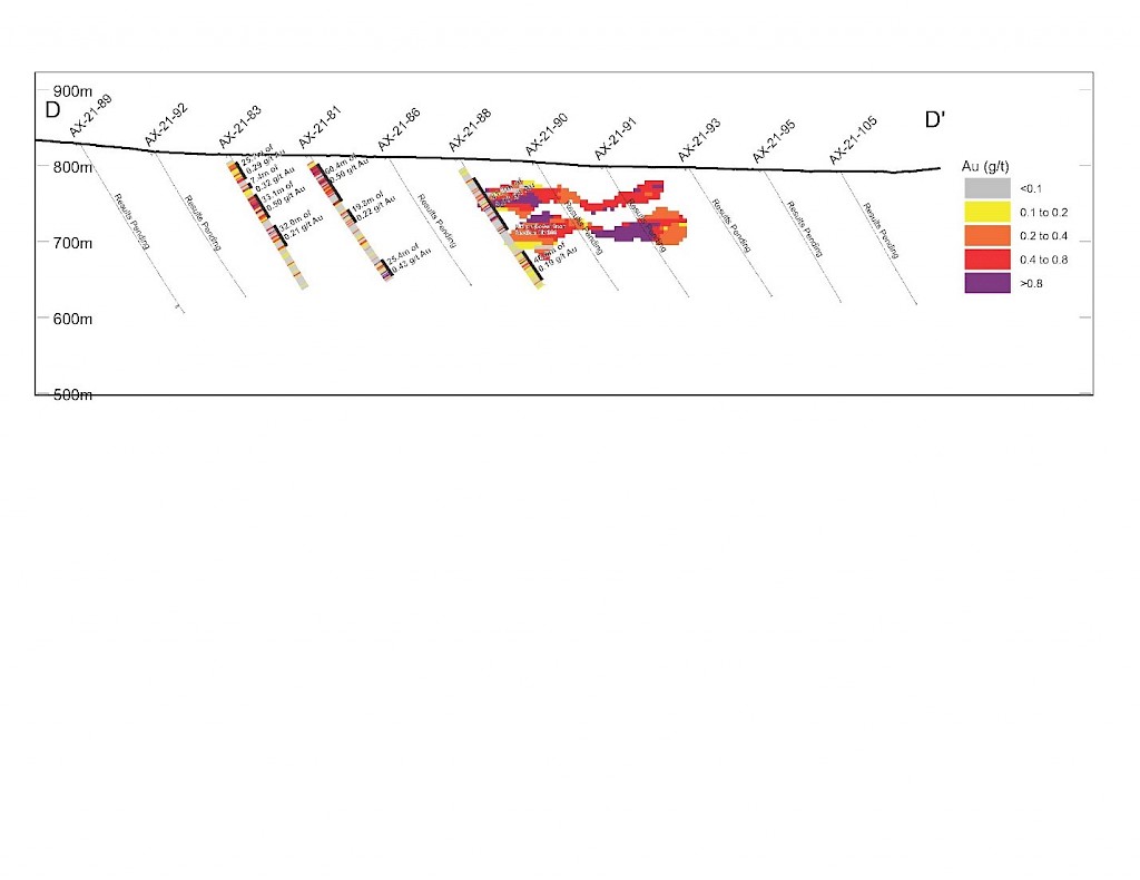
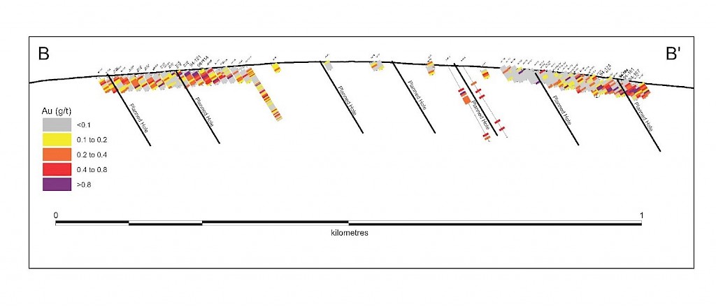
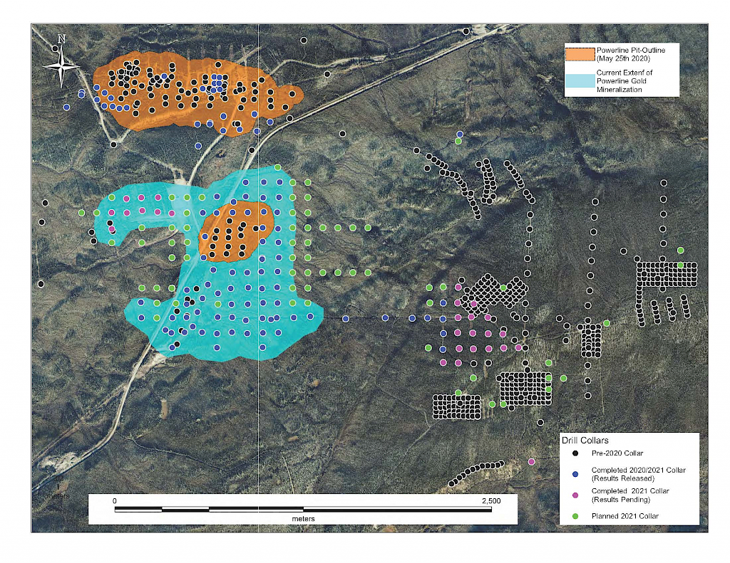
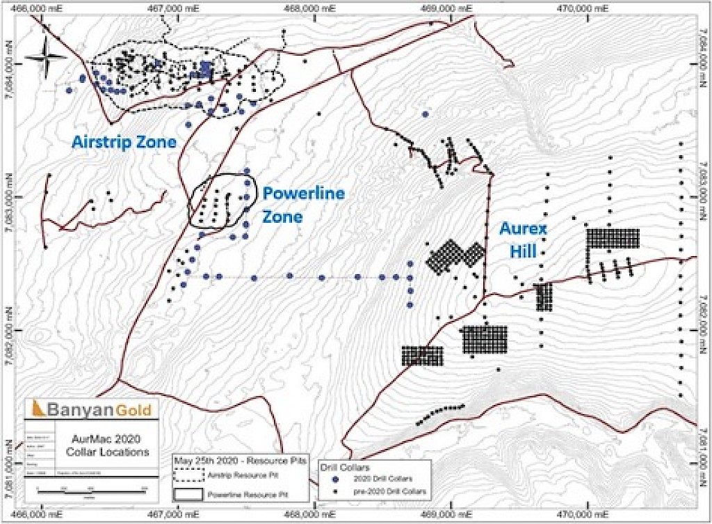
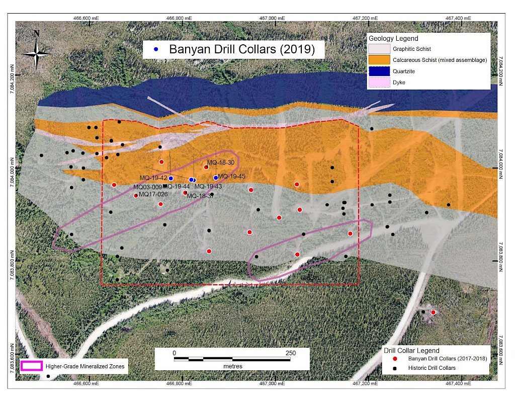
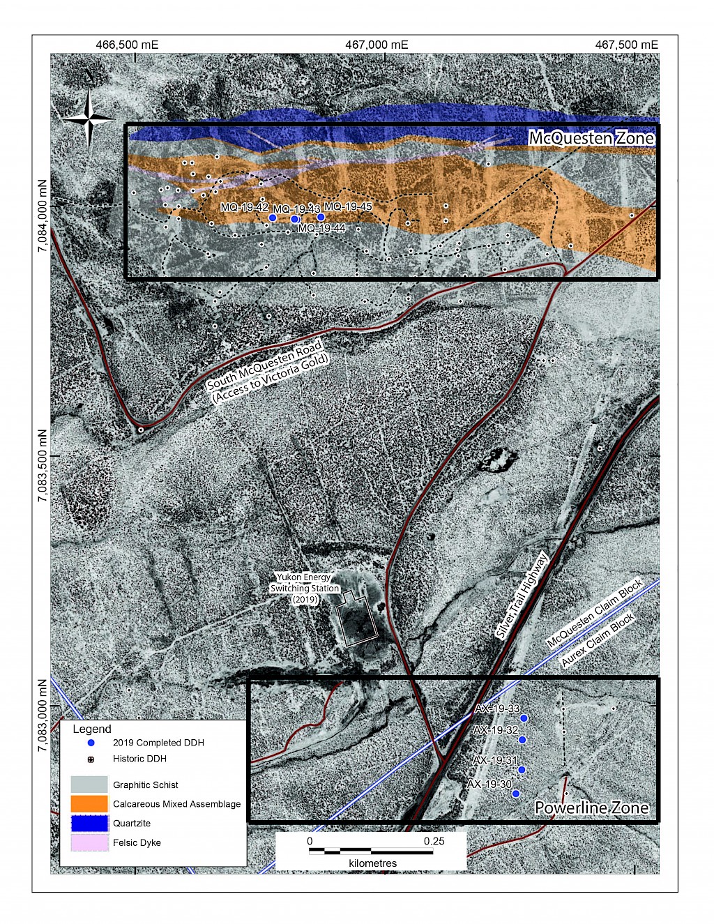
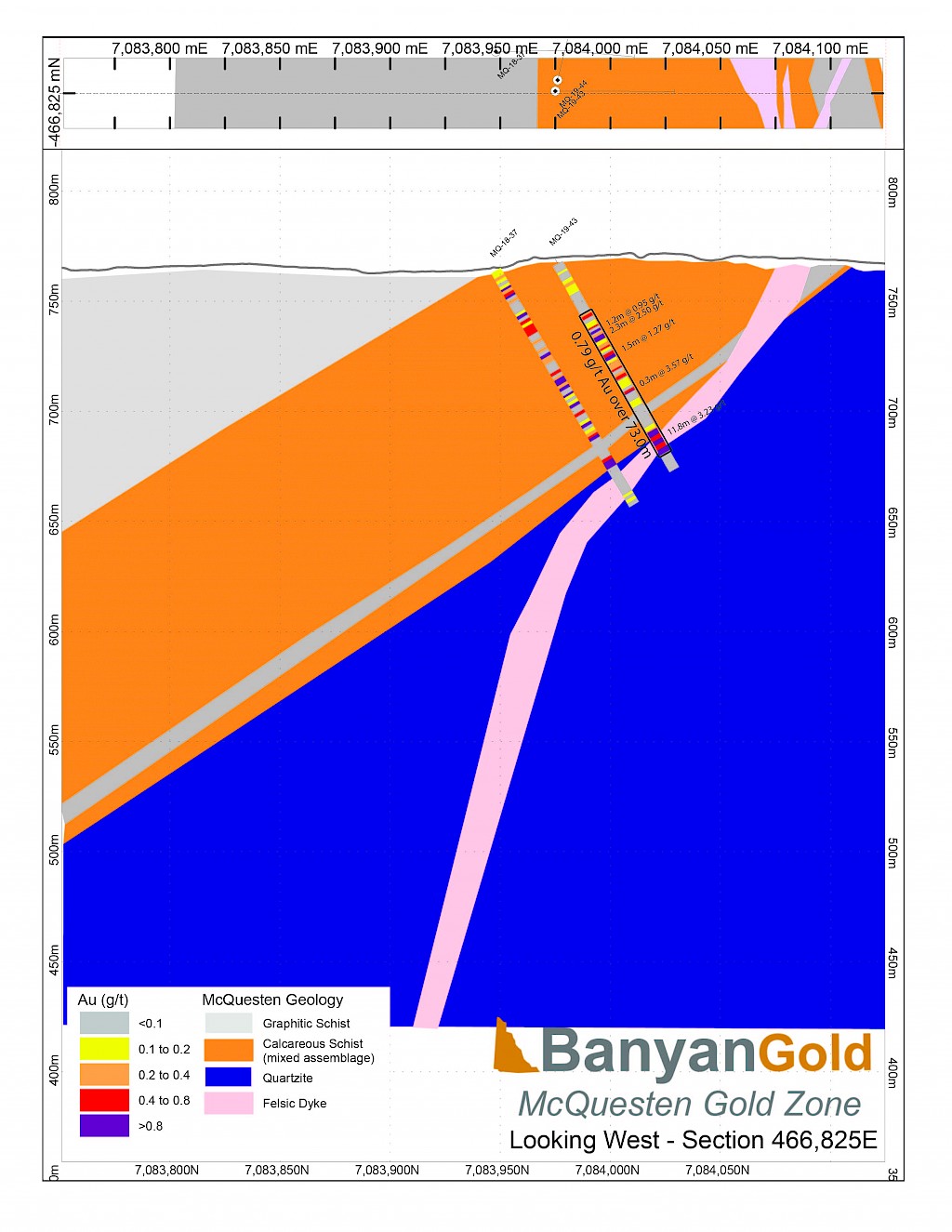
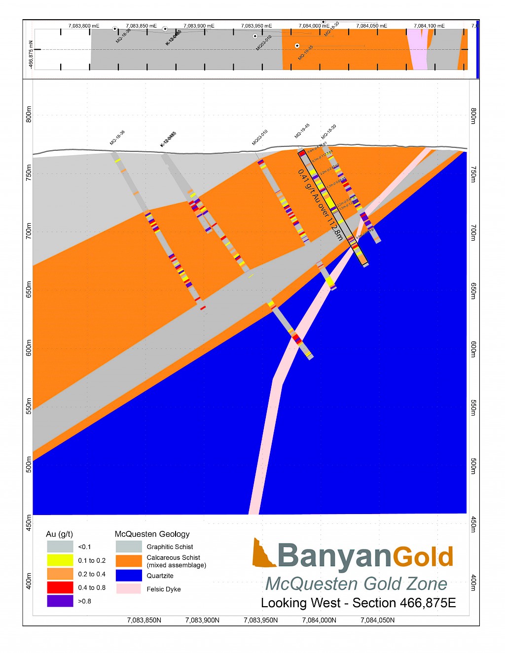
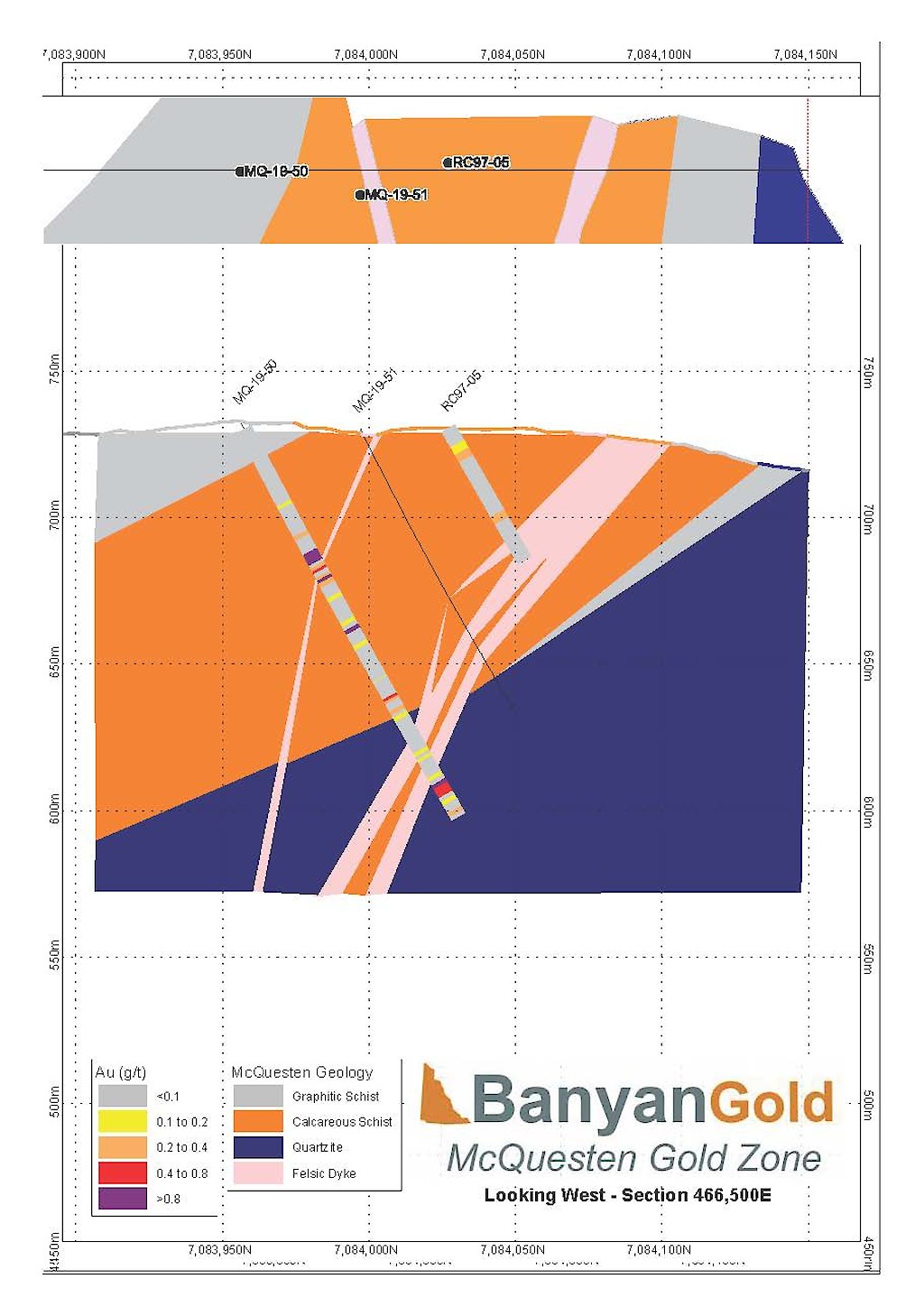
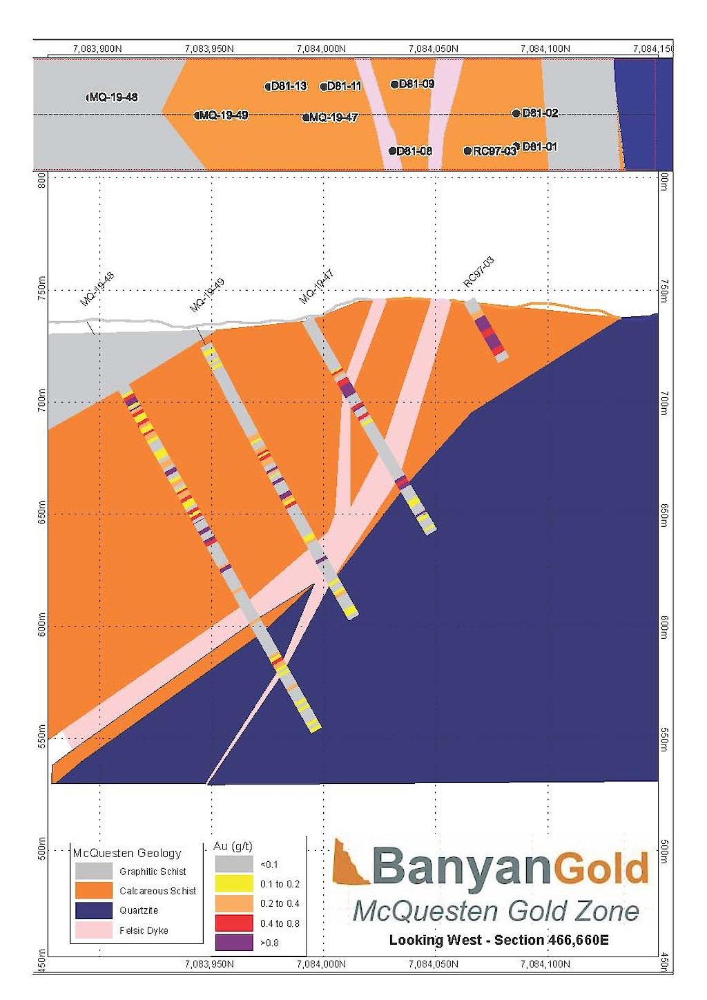
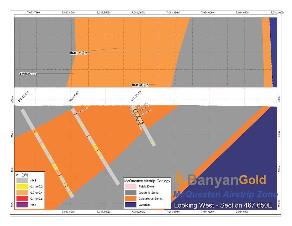
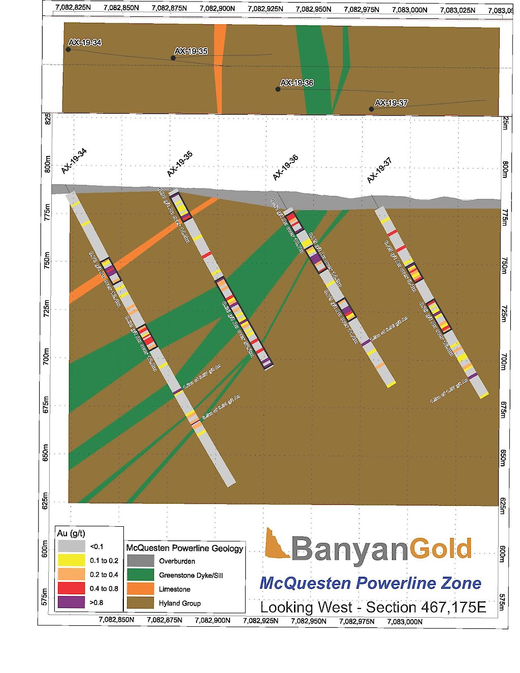
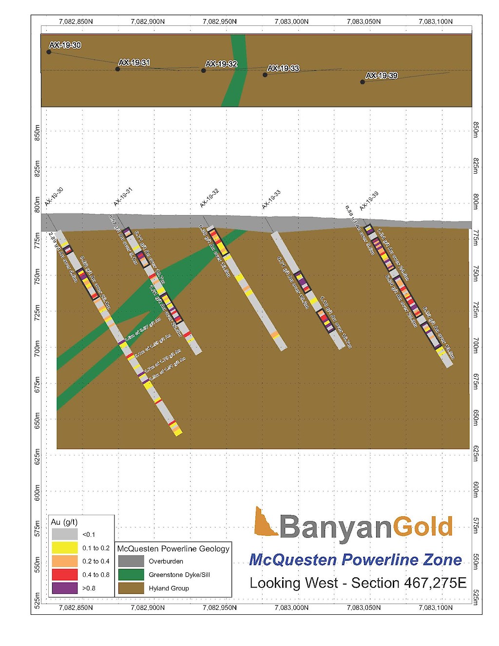
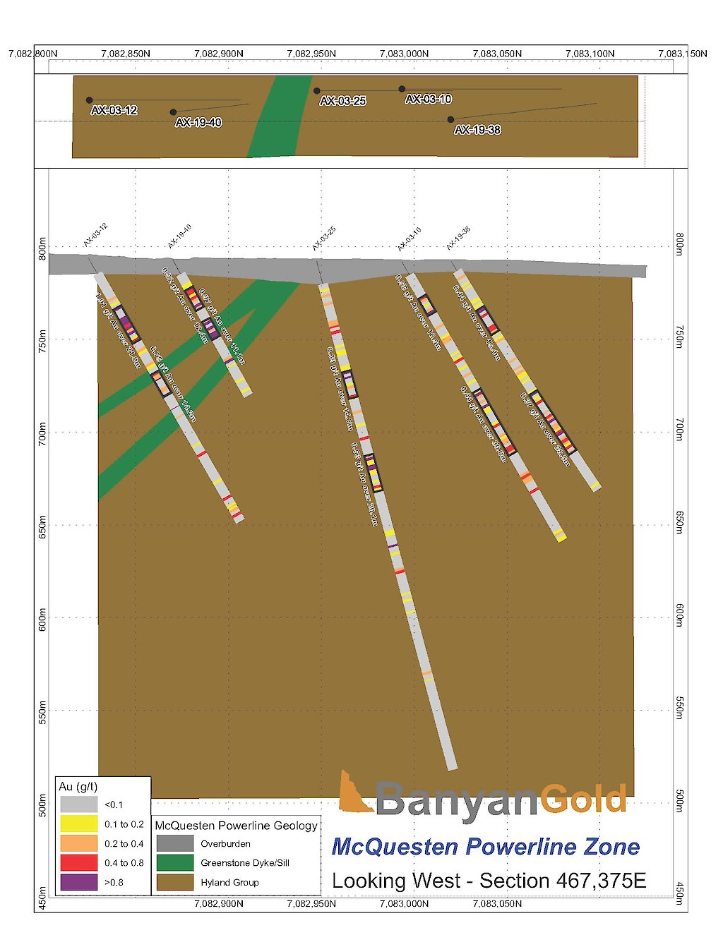
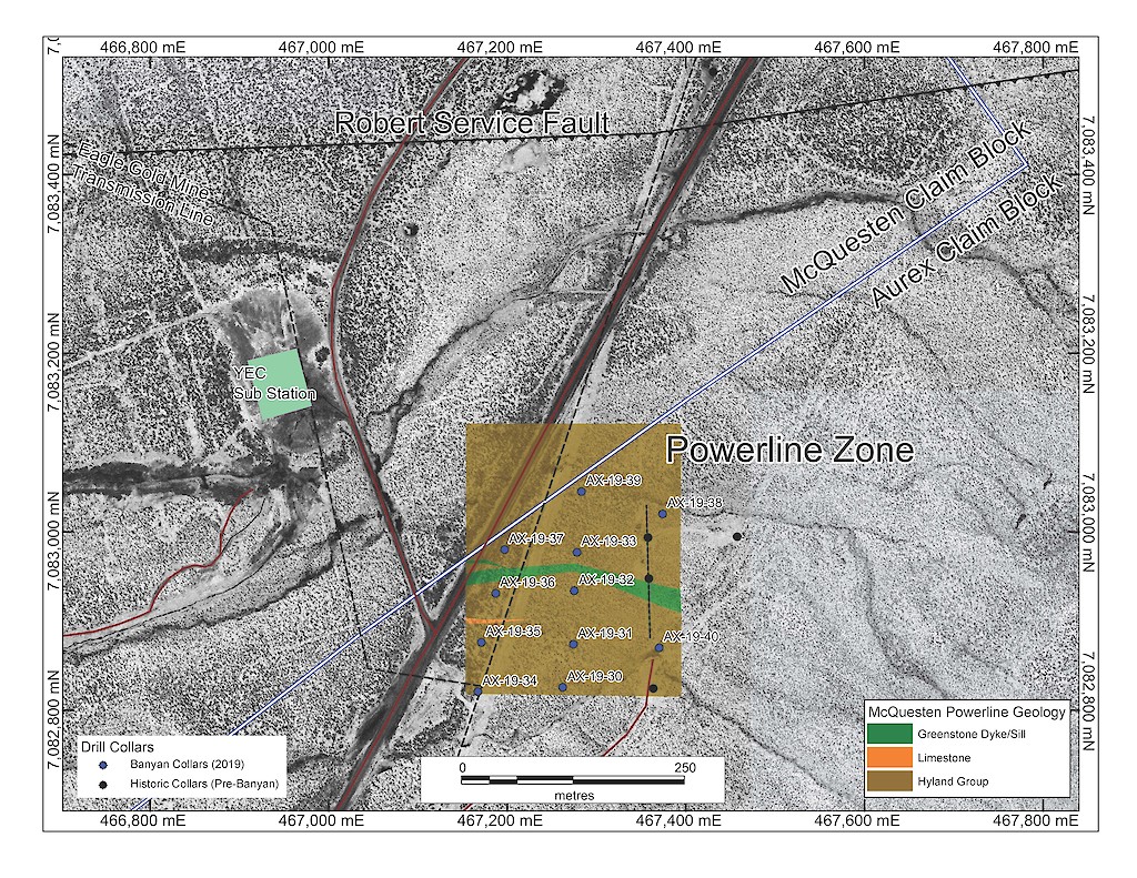
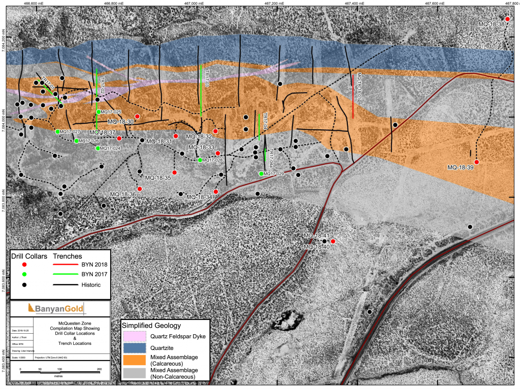
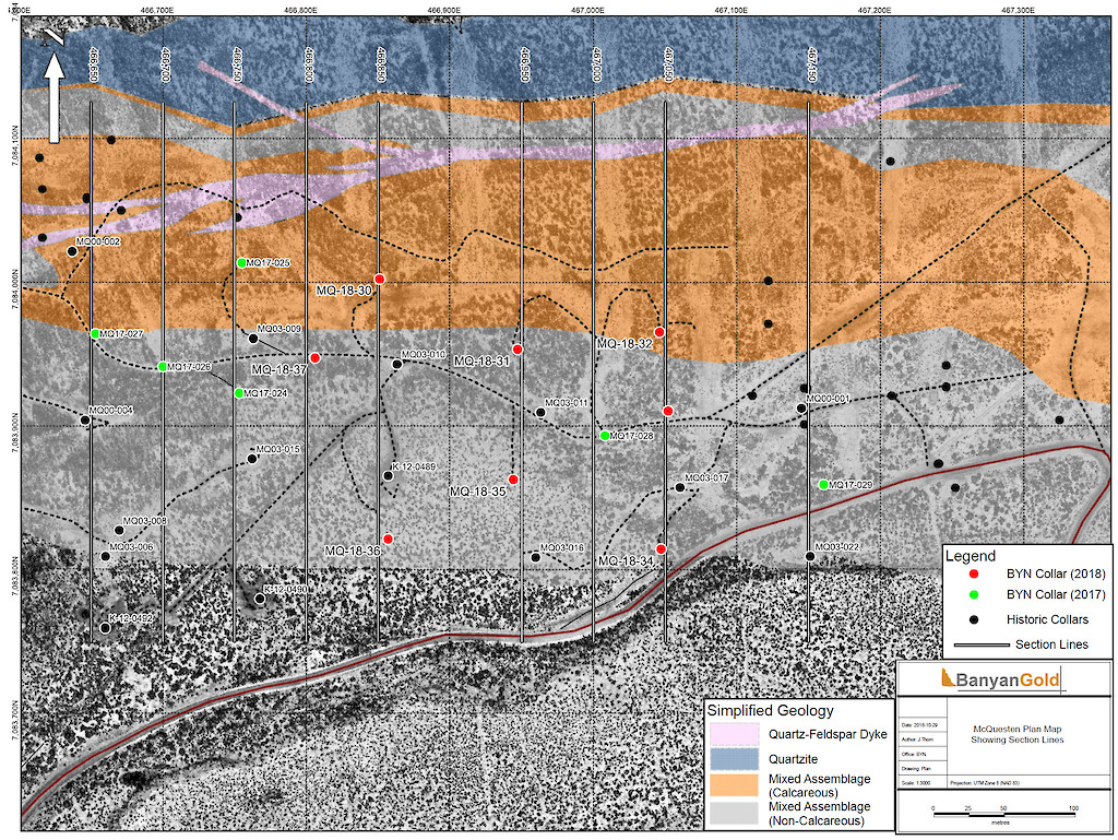
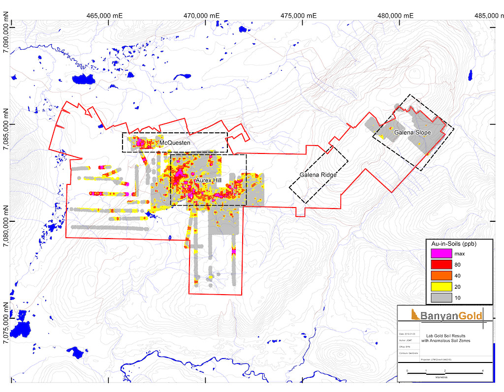
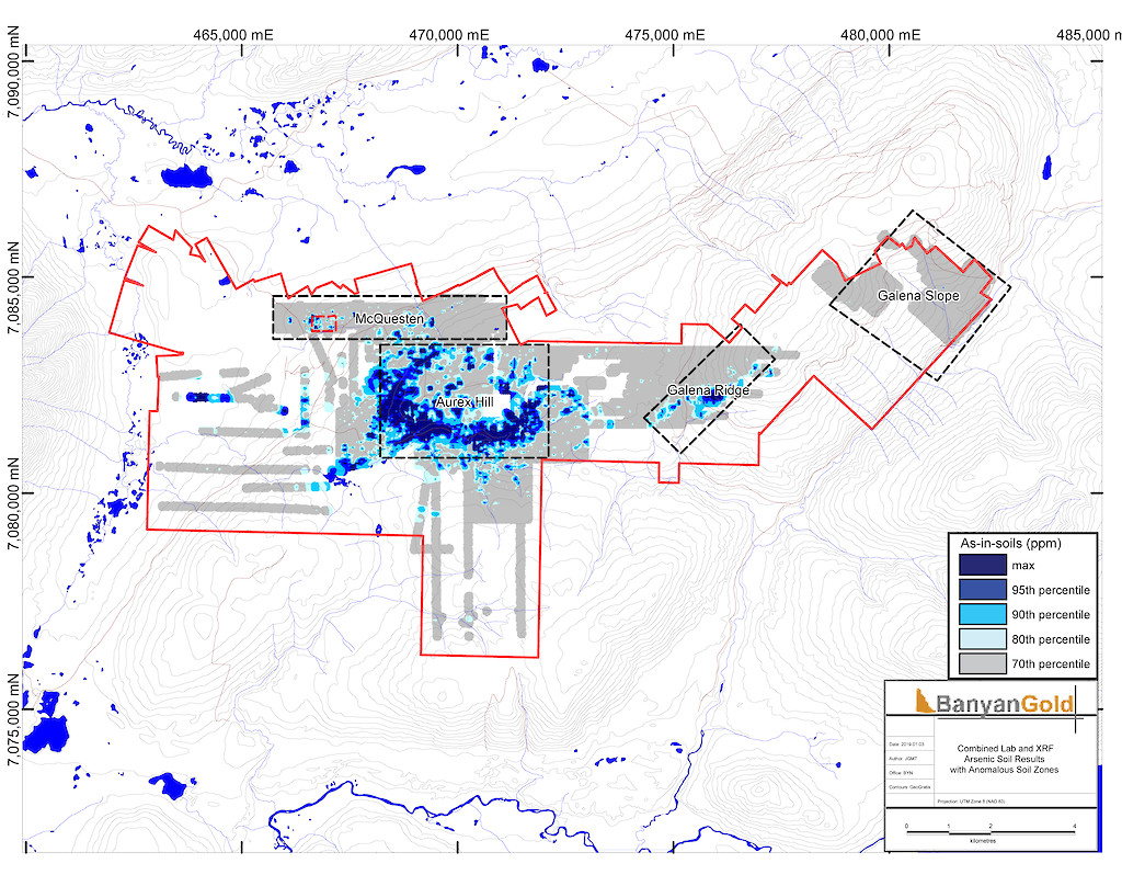
The AurMac Project lies in the northern part of the Selwyn basin and is underlain by meta-sedimentary rocks of the Devono-Mississippian Earn Group and metaclastic rocks of the Late Proterozoic Yusezyu Formation of the Hyland Group. In the McQuesten area, local narrow granitic dykes commonly intrude the metaclastic rocks and are interpreted as intrusions related to the late-Cretaceous Tombstone Intrusive Suite. Gold mineralization is associated with gold bearing skarns surrounding intrusive granitoid dykes, as well as sheeted quartz ± carbonate veins. Regionally, the Tombstone Plutonic suite rocks are spatially and genetically associated with a range of precious and base-metal occurrences including the nearby intrusion-related Eagle Gold Mine hosted within the Dublin Gulch pluton. Since acquiring the properties in 2017, the Company has expanded on the initial targeting of the Airstrip Zone, identified and expanded the over 2.5 km wide by 1 km Powerline Zone, and completed further exploration and expansion of the Aurex Hill Zone.
The AurMac Gold Project is situated around 708300N and 467500E within the Mayo Mining District of central Yukon. The Project lies approximately 40 km northeast from the village of Mayo and 356 km north of Whitehorse, within the traditional territory of the First Nation of Na-Cho Nyak Dun.
The Project is readily accessible by vehicle along the all-weather Silver Highway and the South McQuesten Road (the “Victoria Gold Access Road”). A three-phase power grid line exists on the Project.
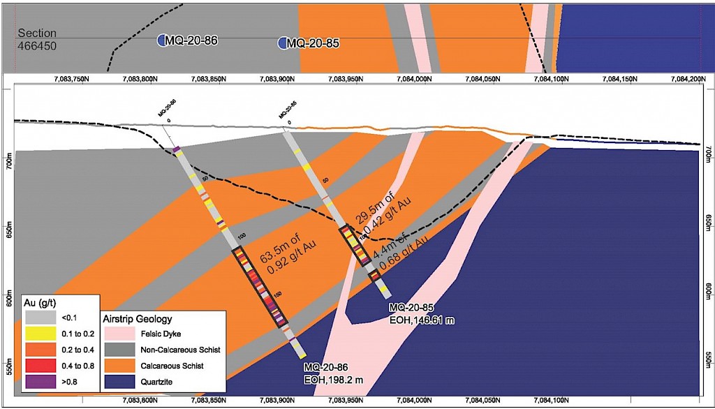
The AurMac Project is located within the north-central part of the Selwyn Basin underlain by metaclastic rocks of the Yusezyu Formation of the Late Proterozoic Hyland Group, and the Mississippian Keno Hill Quartzites. These units have been juxtaposed by northeast directed thrusting in the early Cretaceous by the Robert Service Thrust. The stratigraphy on the Property consists of quartzites, intercalated graphitic phyllites and argillites, lesser limestones, and quartz-sericite schists to the south. All units have been affected by the Tombstone Strain Zone of the underlying non-exposed Robert Service Thrust fault and have been metamorphosed to widespread greenschist facies and quartz–sericite-muscovite facies. Granitic dykes occur locally and are interpreted to belong to the late Cretaceous Tombstone Plutonic suite.
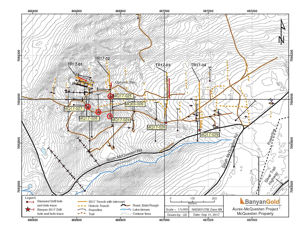
Documented exploration on the AurMac Project (including the McQuesten and Aurex Claim Blocks) dates to 1955 when the Wayne Vein (4581 ppm Ag, 56% Pb, 4.4% Zn, and 2.02 ppm Au) was delineated through trenching and drilling on the Wayne and Don claims within the McQuesten Claim Block. Work on the Aurex Claim Block has been well-documented since 1992 when the original claims were staked for possible Fort Knox and Dublin Gulch style mineralization. Initial prospecting in the Aurex Claim Block that year delineated Au-mineralized retro-grade skarn-altered calcareous sediments sampled from 36 trenches. Since then, further work has been completed throughout the Project including surface geochemical sampling, additional trenching, drilling and geophysical surveying.
Within the McQuesten Claim Block, previous operators who carried out this work include Island Mining and Explorations Co. Ltd (IME, 1981-1983), Hemlo Gold Mines (1995), Eagle Plains Resources and Miner River Resources (1997), Viceroy International Exploration/Viceroy Exploration Canada (1997-1998), Newmont Exploration of Canada Ltd. (2000), Spectrum Gold Inc, (2003) and Alexco Resources Corp. (Hecla Mining, 2005-2012). Previous operators who carried out work on the Aurex Claim Block include Yukon Revenue Mines Ltd. (1993-1998), Expatriate Resources Ltd. (1999), Newmont Exploration of Canada Ltd. (2000), Stratagold Corp. (2003-2009), and Victoria Gold Corp. (2009-2016).
Since consolidation of the McQuesten and Aurex Claim Blocks by Banyan Gold Corp. in 2017, further staking was carried out to expand the Project to its current 1498 quartz claims totalling over 30,300 hectares (303 km2).
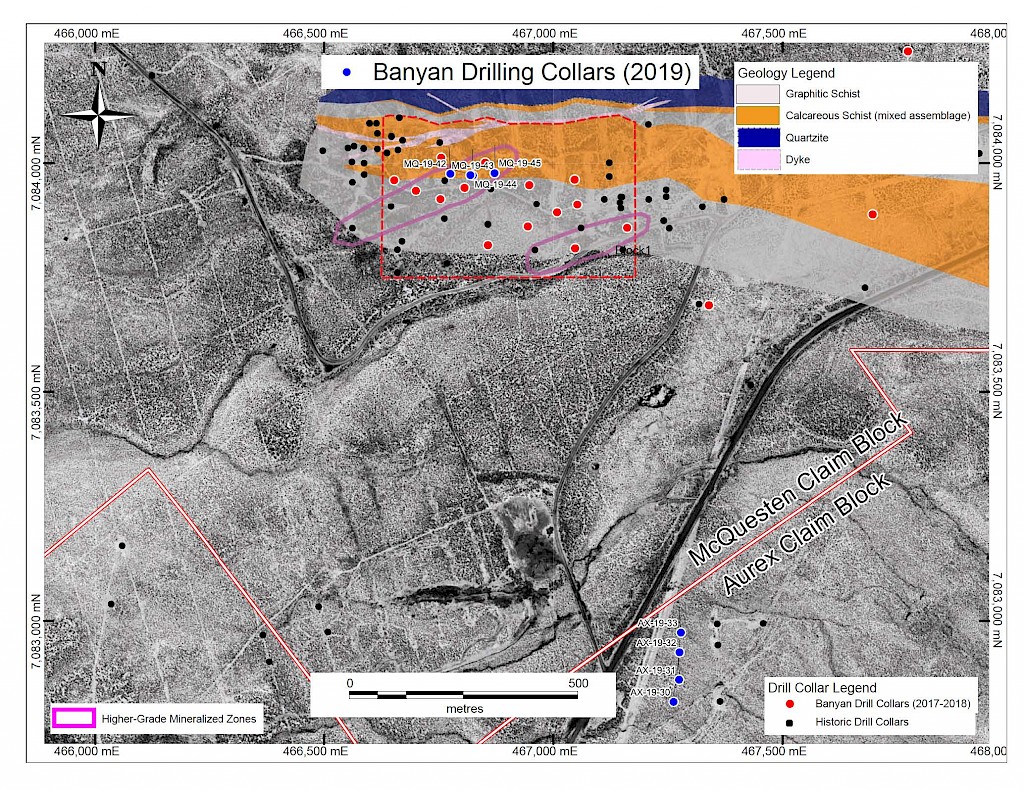
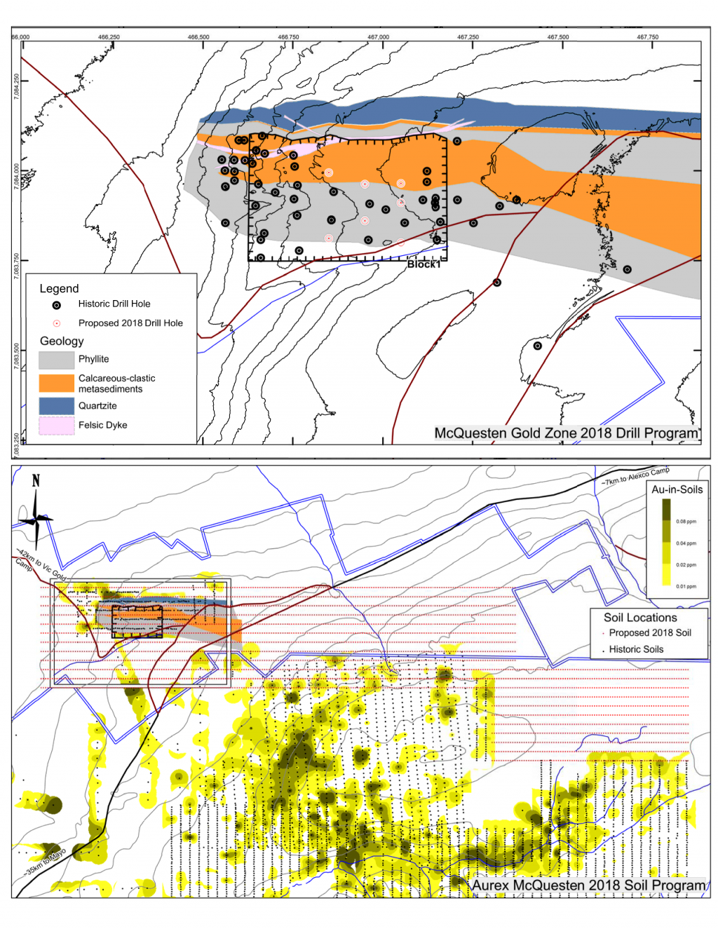
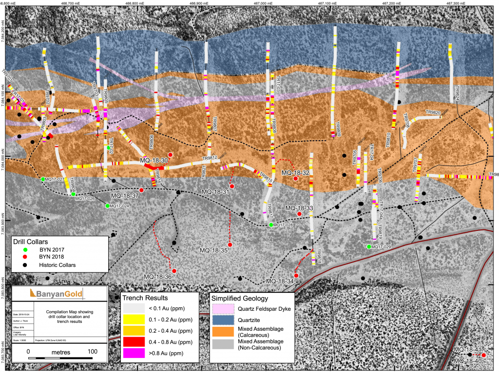
In 2017, Banyan carried out its inaugural exploration program on the consolidated AurMac Property. On the McQuesten Claim Block 317 soil samples were collected to expand on the surface geochemical dataset, five (5) additional trenches totalling 342 metres (“m”) tested historic trenching data and Au-in-soil anomalies, six diamond drillholes (913 m) targeting mineralization through the Airstrip Zone, and 181 line-kilometres of airborne radiometric and magnetic surveying was completed. Work was also completed on the Aurex Hill Zone consisting of 695 soil samples, highlighting a positive Au-Bi correlation, and four diamond drillholes (509 m) targeted anomalous intercepts form 1994 and 1995 rotary air-blast drilling.
In 2018, further surface geochemical data collection and trenching was completed in the McQuesten Claim Block to fill in gaps in historic datasets, as well as to expand the Airstrip Zone footprint including 1,310 soil samples and a single 108 m trench. An additional twelve diamond drillholes totalling 1,414 m were drilled to complete infill drilling within 2017 drilling, investigate underlying stratigraphy, and extend the Airstrip Zone on-strike to the east. Soil sampling was also carried out on the Aurex Claim block in 2018 consisting of 2,388 samples to expand the Aurex Hill Zone and identify new targets on the Property.
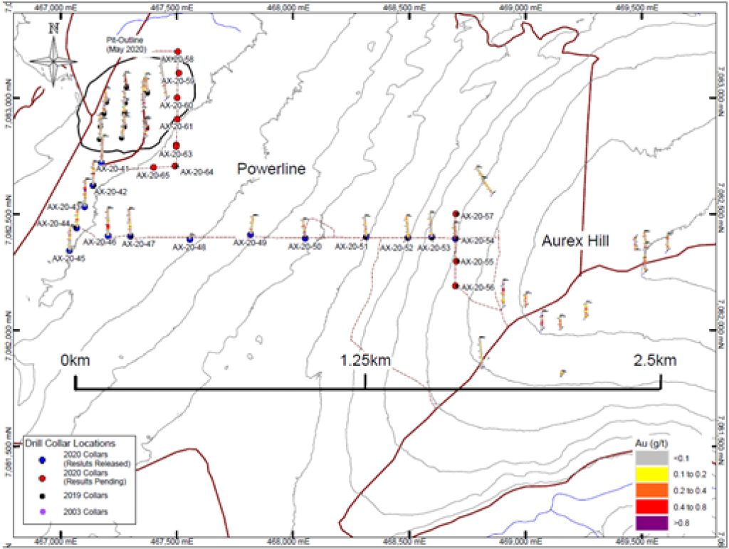
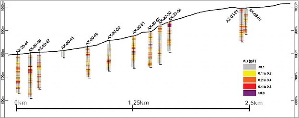
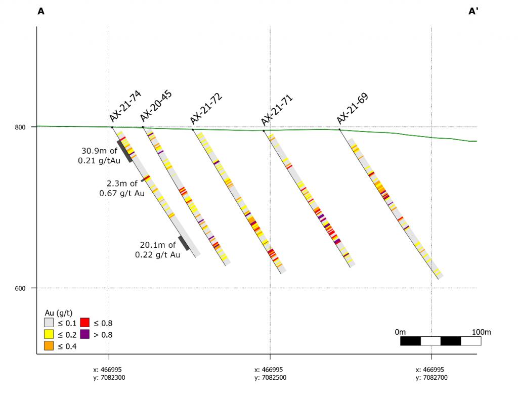
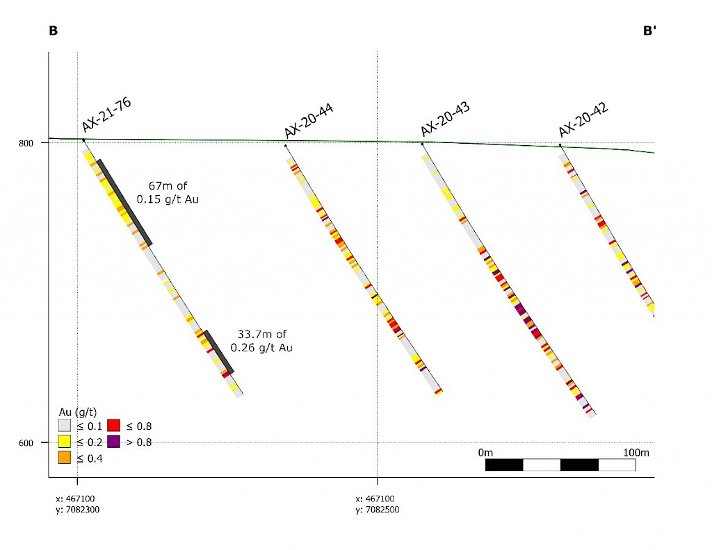
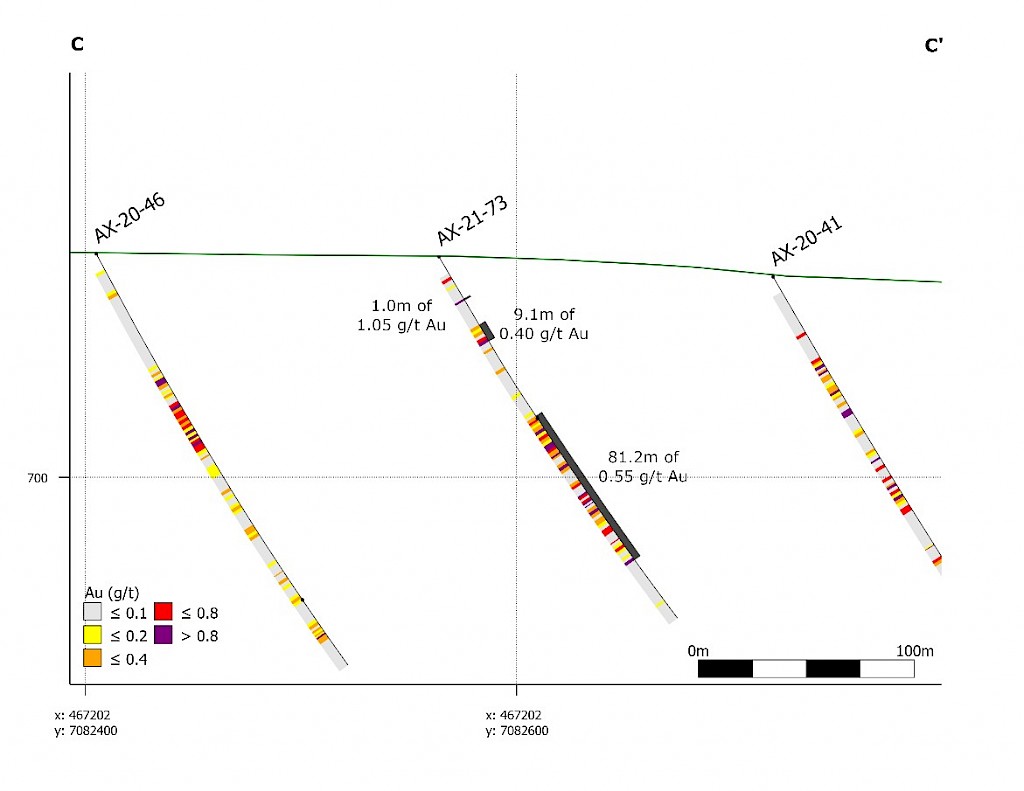
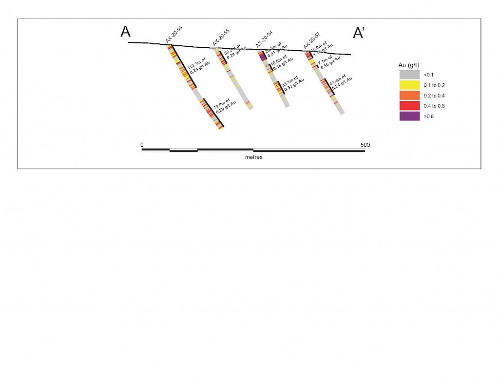
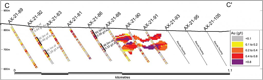
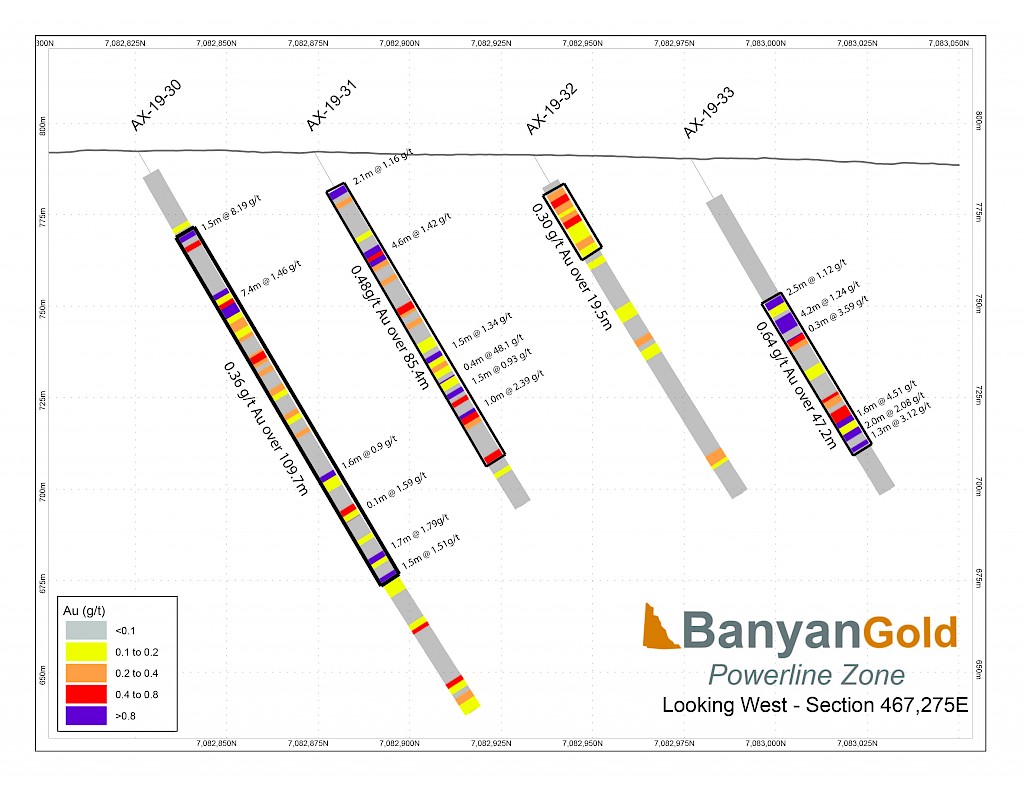
Work carried out in 2019 included two (2) new trenches in the Airstrip Zone totalling 175 m, twenty-three (23) diamond drillholes totalling 3,012 m, and five reverse-circulation drillholes totalling 497 m. Four of the diamond drillholes (494 m) and reverse-circulation drilling were designed to infill around higher-grade intercepts within earlier drilling of the Airstrip Zone. A second phase of step out drilling comprised of nineteen diamond drillholes (2,518 m). Inaugural drilling of the Powerline Zone occurred in 2019 intended to step out from three historic diamond drill holes completed in 2003. In total eleven holes were drilled (1,375 m) and returned anomalous Au intercepts.
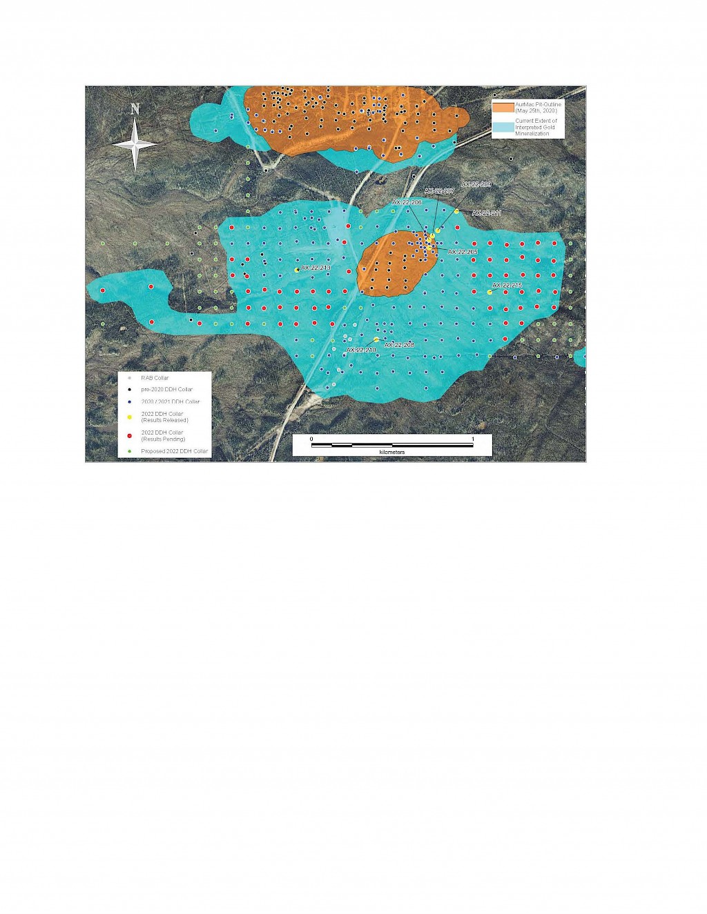
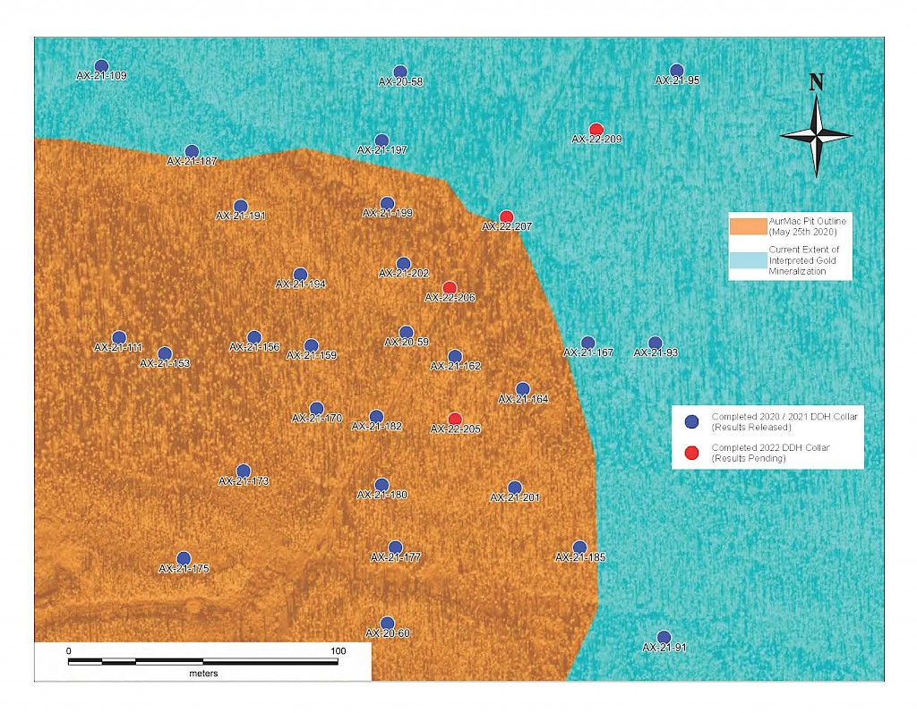
In 2020, Banyan released an initial inferred mineral resource for the Airstrip Deposit, based on work completed from 2017-2019, and also the Powerline Zone, based on drilling completed in 2019. These new inferred resources for the Airstrip and Powerline Zones totalled 775 koz Au with an average grade of 0.52 g/t at a 0.2 g/t Au cut-off in the and 129 koz Au with and average grade of 0.61 g/t Au at a 0.2 g/t cut-off respectively.
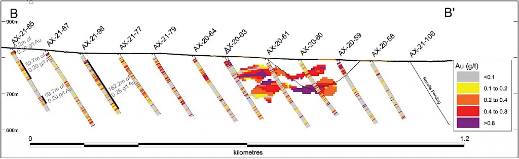
Further drilling was carried out in the same year to again infill around higher-grade intercepts in the Airstrip Zone and to step-out from known mineralization in both Airstrip and Powerline Zones to increase their mineralization footprints. In the Airstrip Zone, thirty-two diamond drillholes were drilled (6,087 m), with ten drillholes (1,568 m) designed for infill and twenty-two drillholes (4,519 m) intended for step-outs. In the Powerline Zone, 25 diamond drillholes (4,547 m) were completed, stepping out from previous drilling.
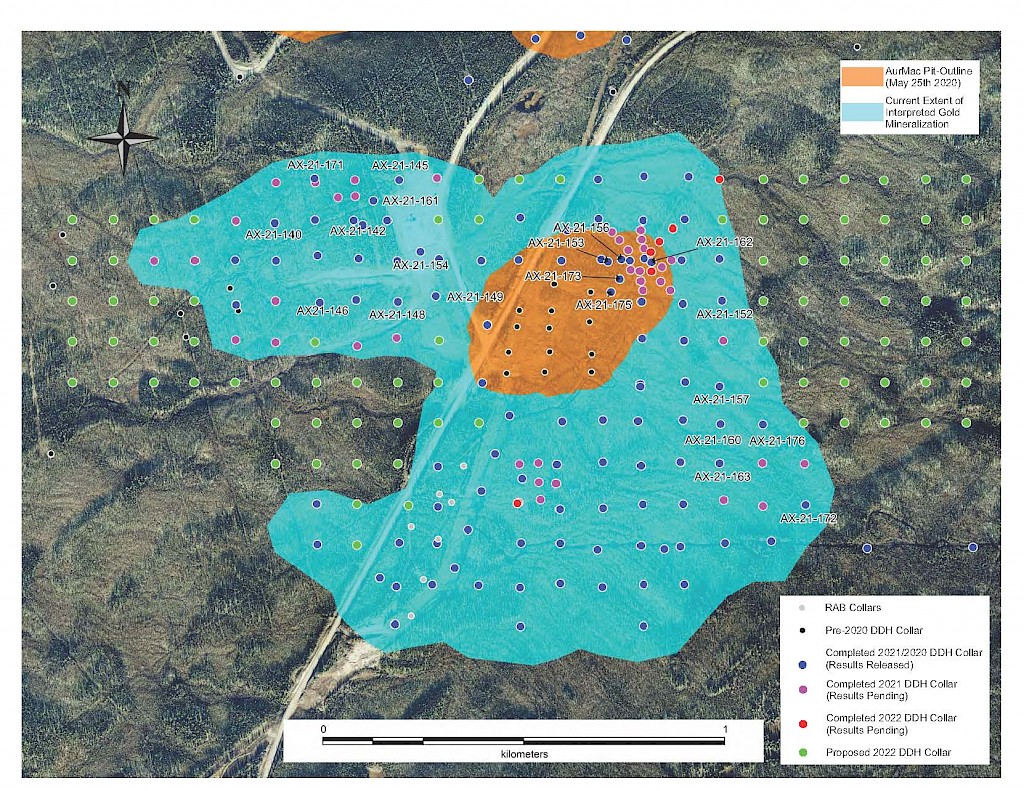
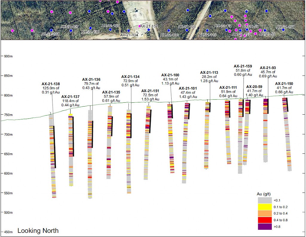
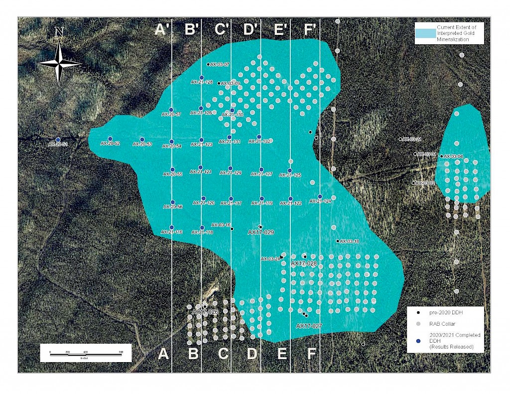
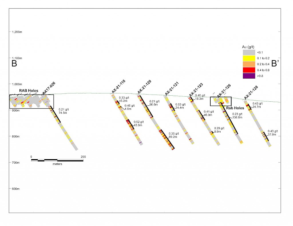
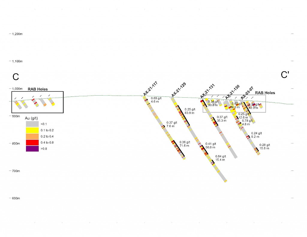
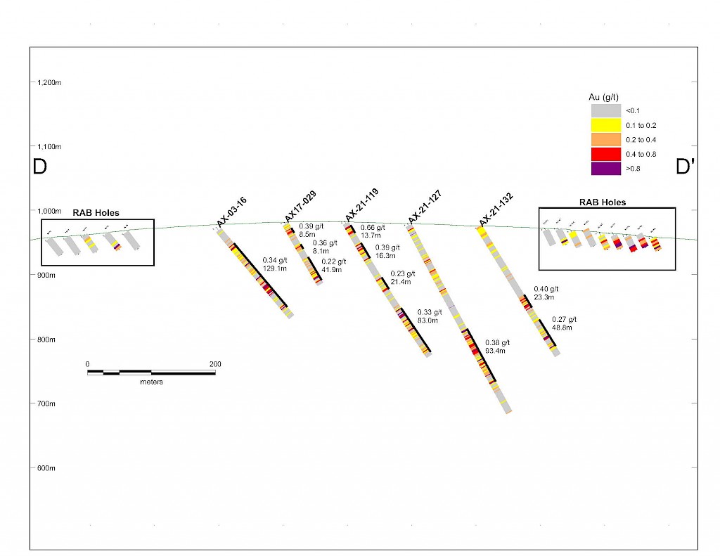
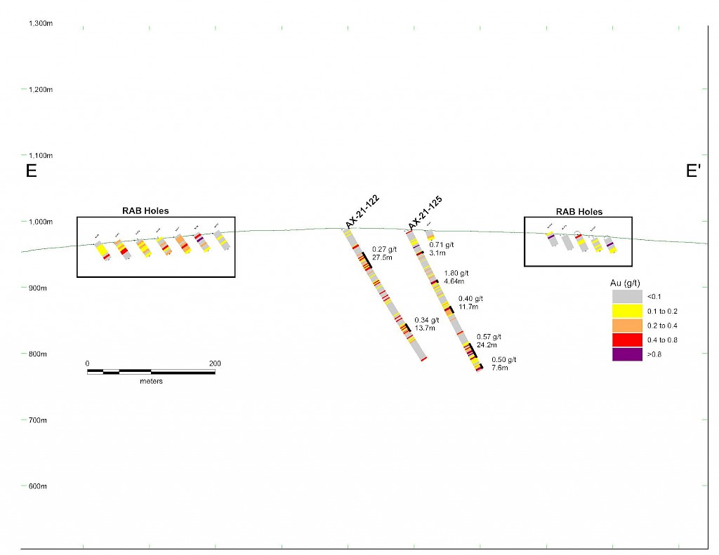
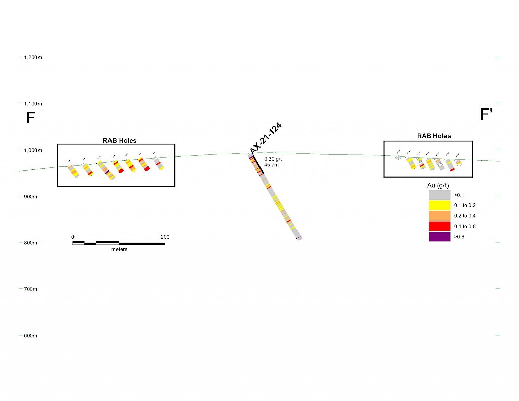
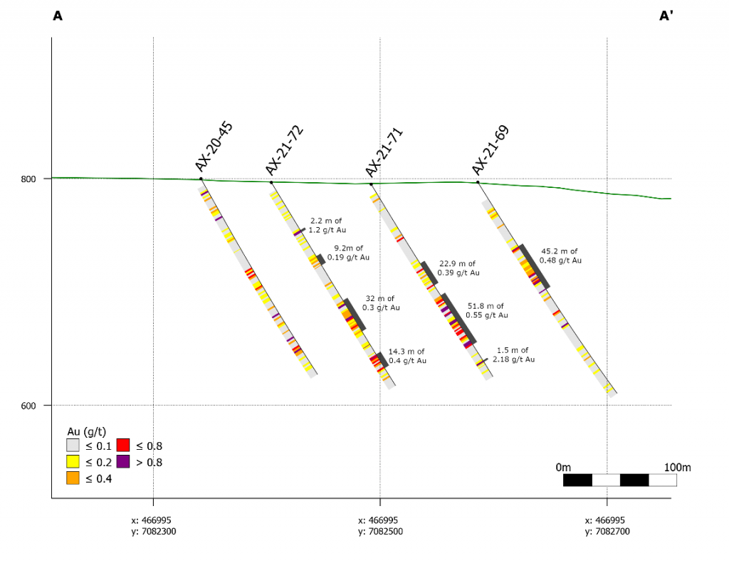
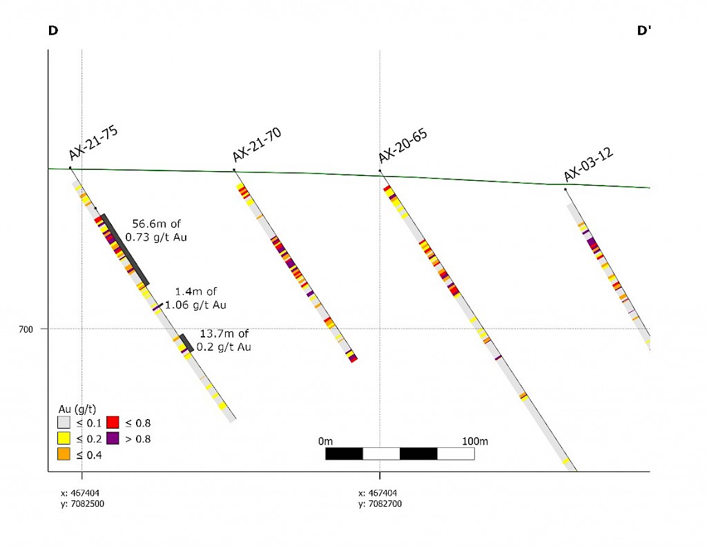
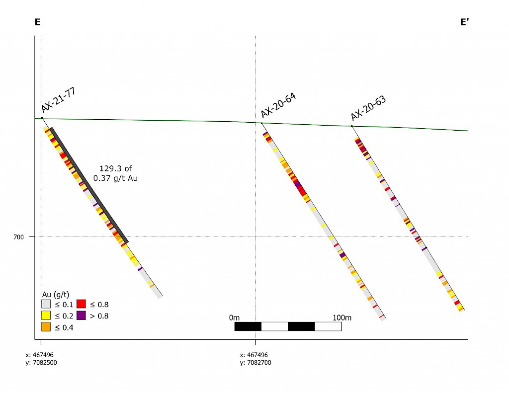
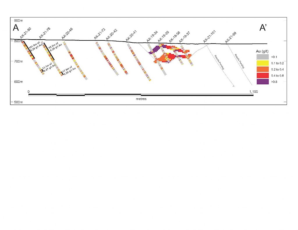
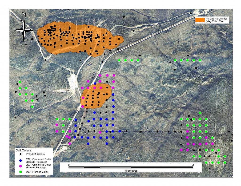
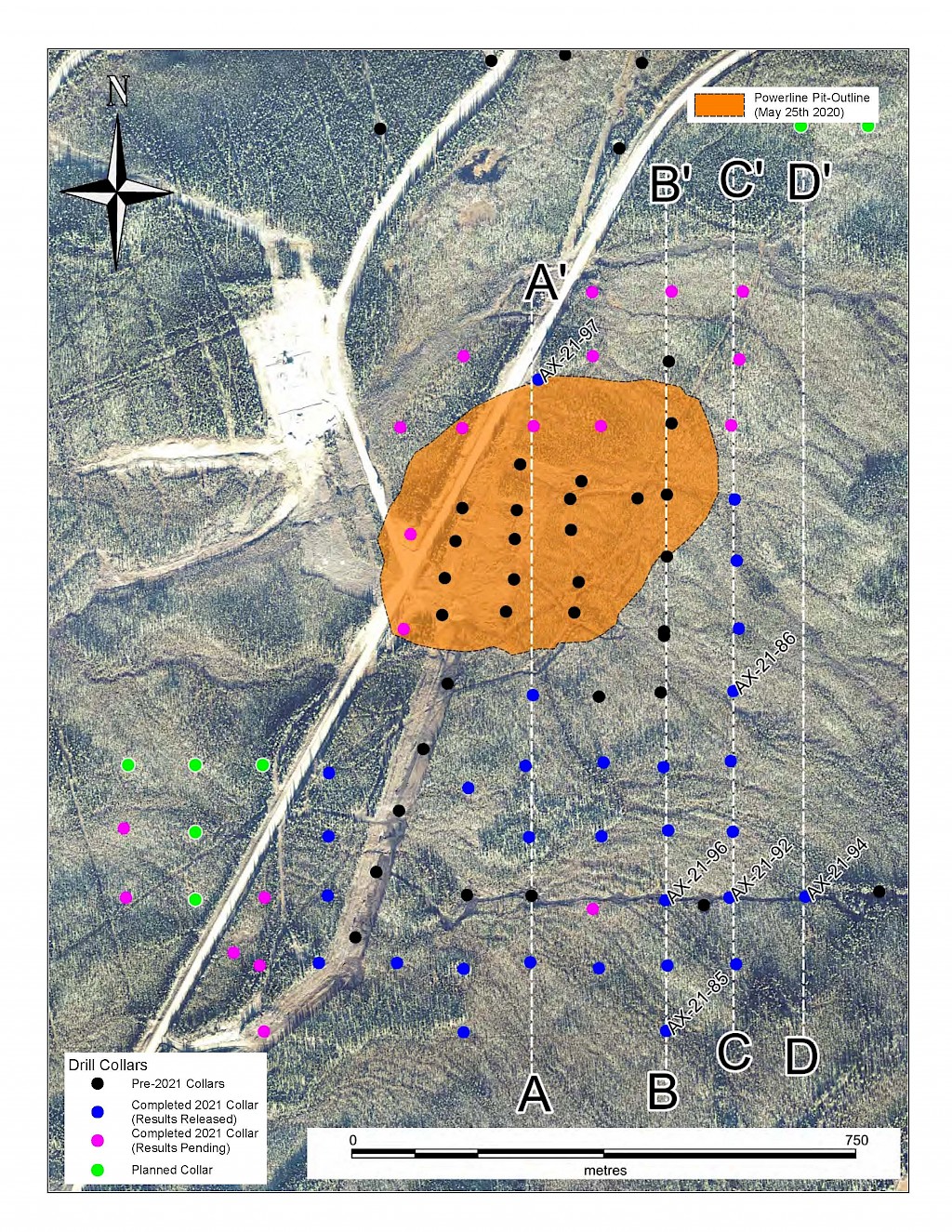
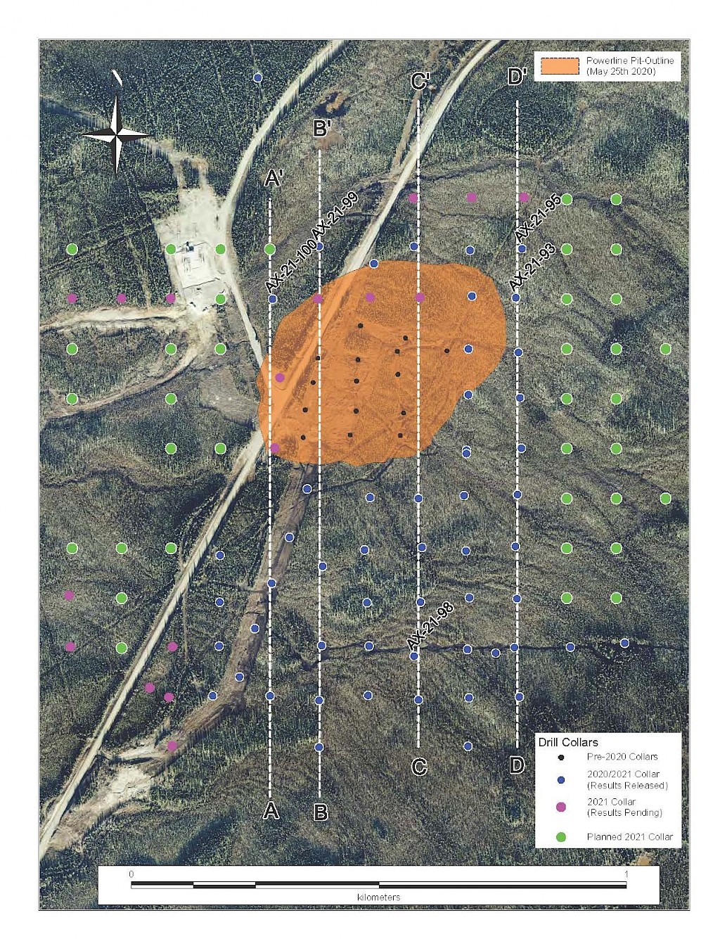
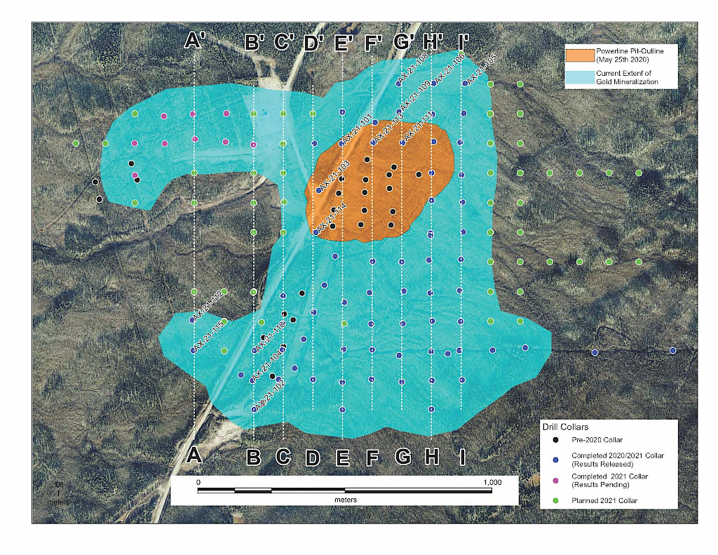
In 2021, step-out drilling continued in the Powerline and Aurex Hill Zones which successfully expanded the footprint of both zones. In Powerline, one-hundred and twenty-one (121) diamond drillholes (26,128m) were completed, and eighteen diamond holes (4,410 m) were completed on Aurex Hill. Upon the success of the 2021 drilling season, a resource update was planned for early 2022.
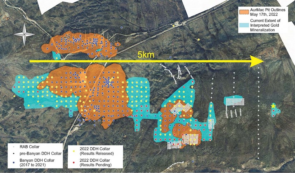
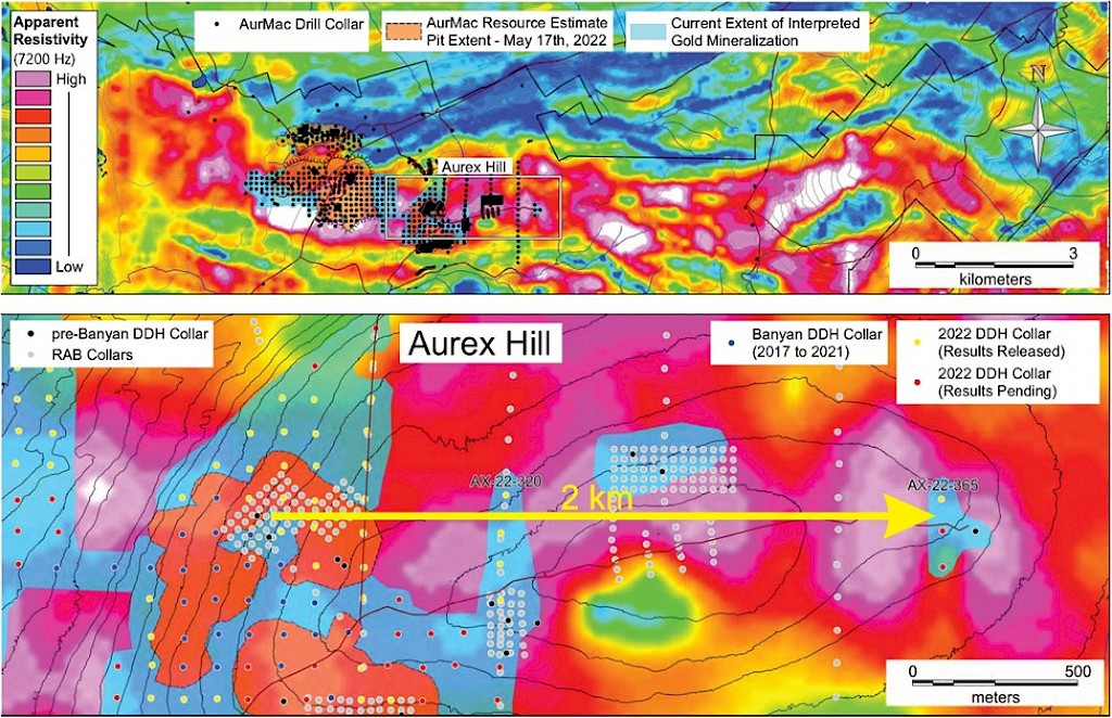
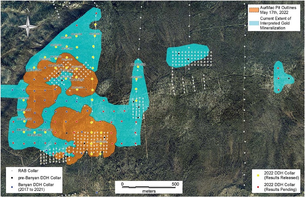
On May 17, 2022, a resource update was released for the AurMac Project culminating from all the work completed from 2017-2021. The inferred resource for the entire project totalled 3,990,000 oz Au with an average grade of 0.60 g/t and cut-offs ranging from 0.2-0.3 g/t Au. Zone-wise, Airstrip totalled 875 koz Au at 0.64 g/t Au with a 0.2 g/t Au cut-off, Powerline totalled 2,989 koz Au grading 0.59 g/t Au with a 0.2 g/t Au cut-off, and Aurex Hill’s maiden resource totalled 215 koz Au grading 0.53 g/t Au with a 0.3 g/t Au cut-off.
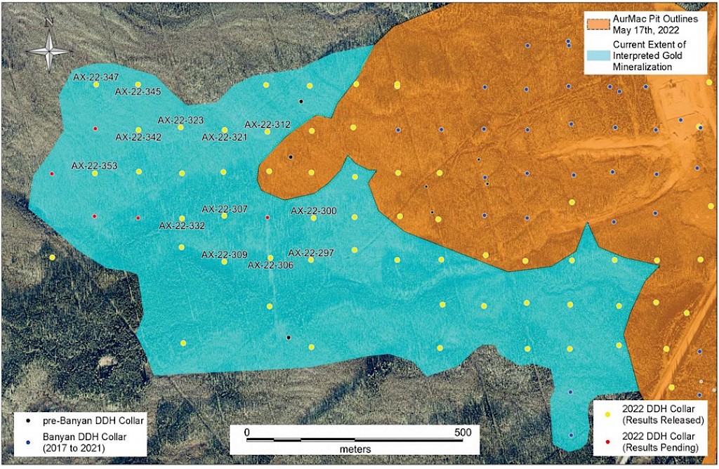
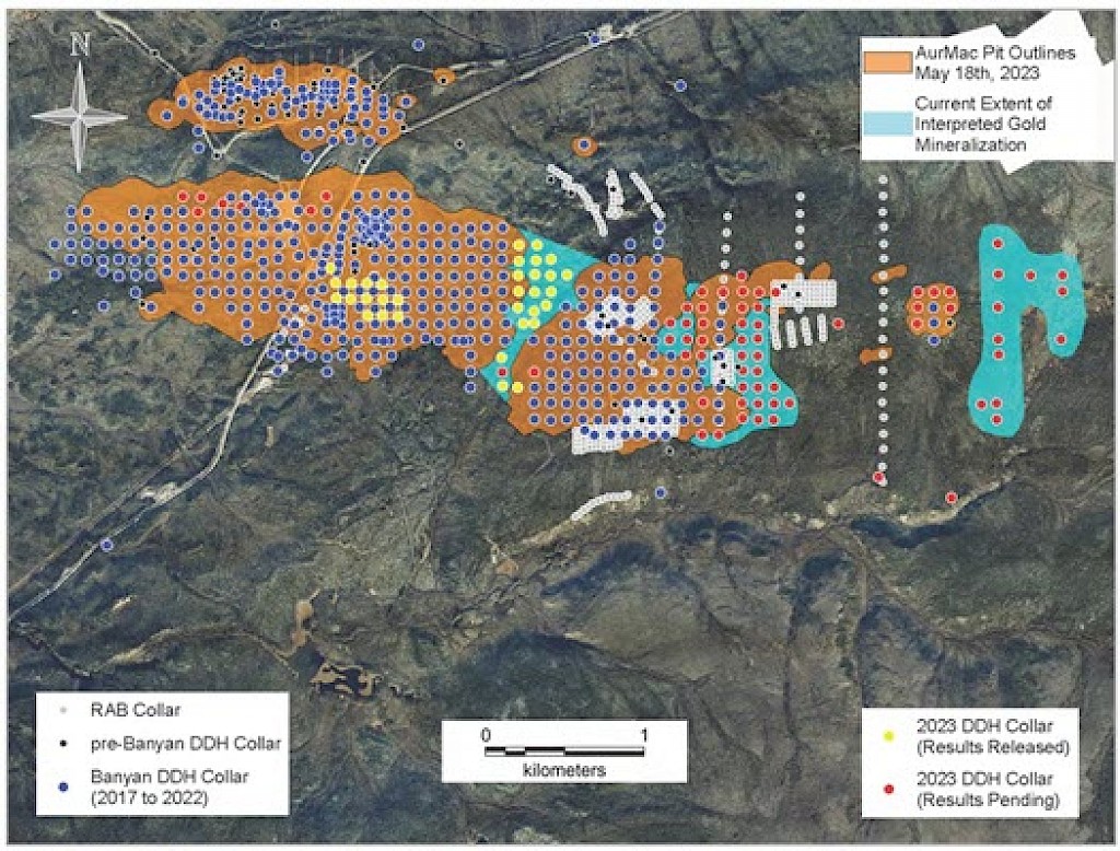
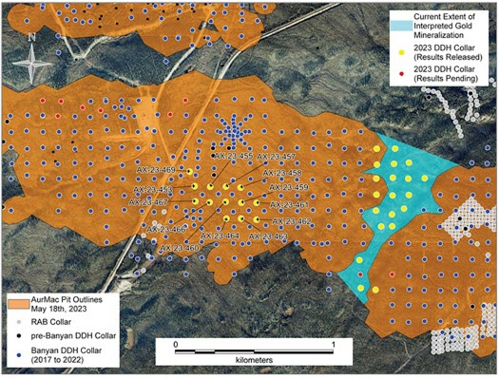
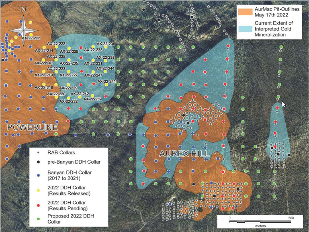
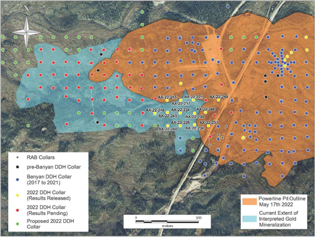
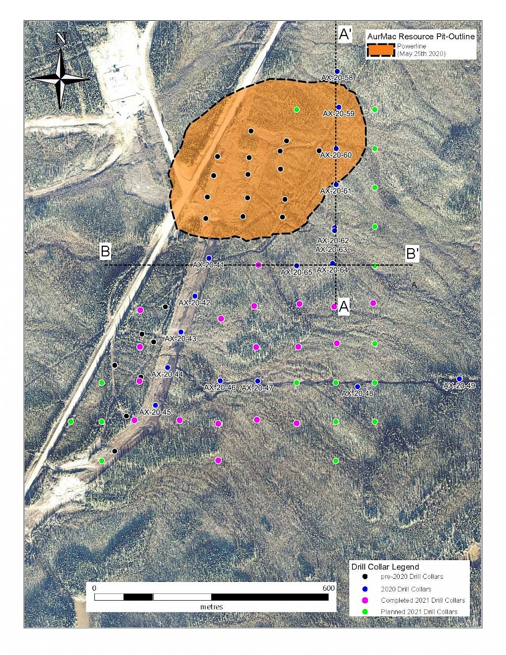
Banyan Gold Corp.’s 2022 field season commenced in late-January 2022 and consisted of approximately 50,000m of diamond drilling. Step-out drilling continued in the Powerline and Aurex Hill Zones to expand both of their mineralization footprints. In Aurex Hill, a total of 54 diamond drill holes (9,073 m) were drilled, with three holes (573 m) targeting anomalous Au is historic reverse-circulation drillholes located in the eastern portion of the zone. In the Powerline Zone, one-hundred and fifteen (115) step-out diamond drillholes (28,034m) were completed to the east and west of previous drilling bringing the total footprint width from 1.75km to its current 2.5 km.
As of October 2024, Banyan has completed 180,000m of drilling accross 861 holes on the Aurmac property.
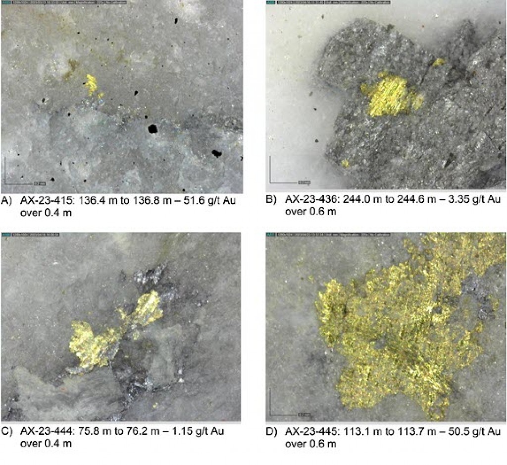
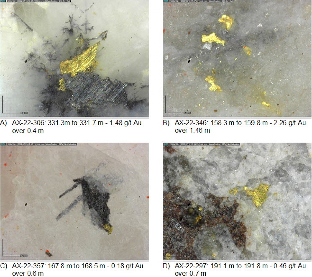
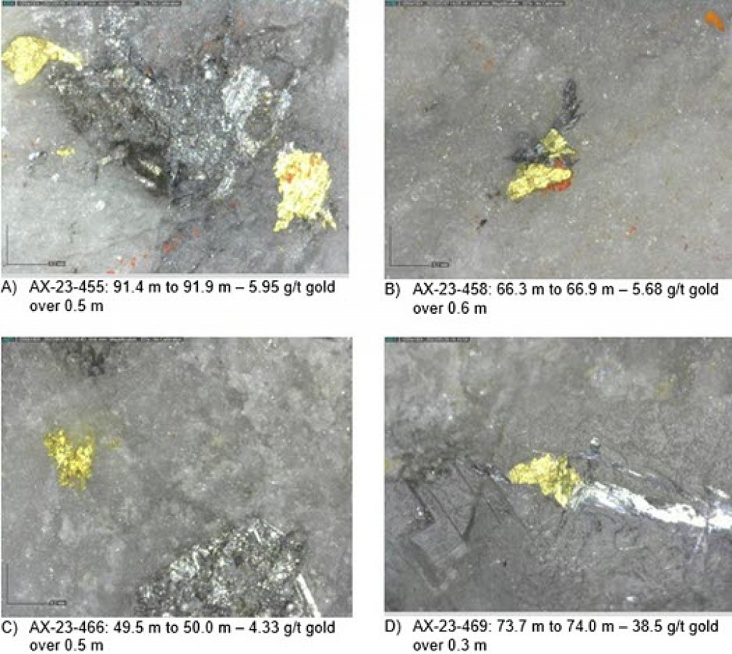
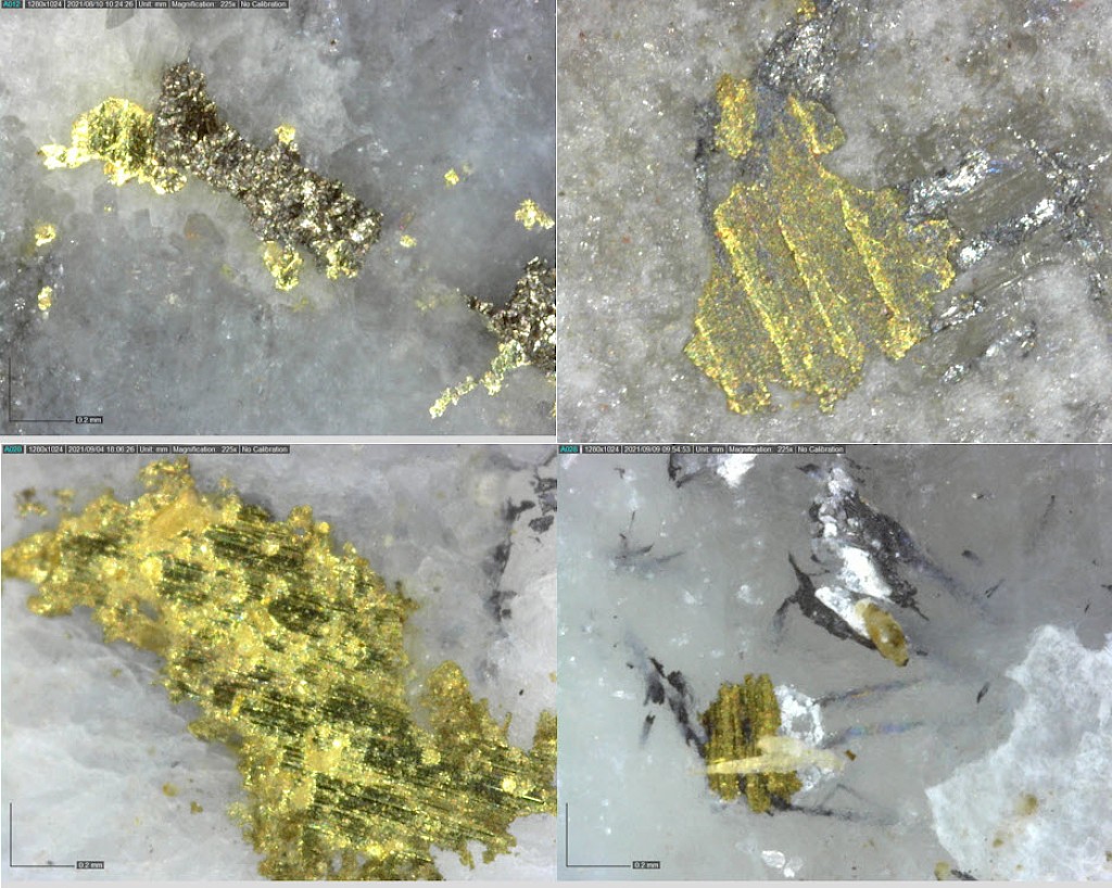
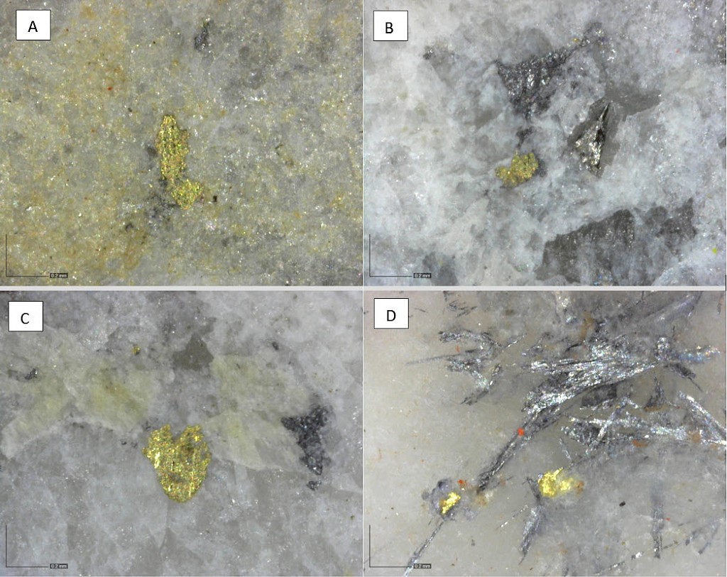
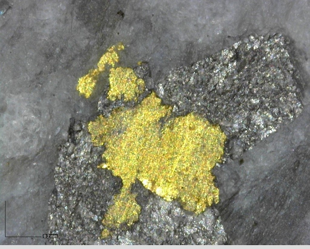
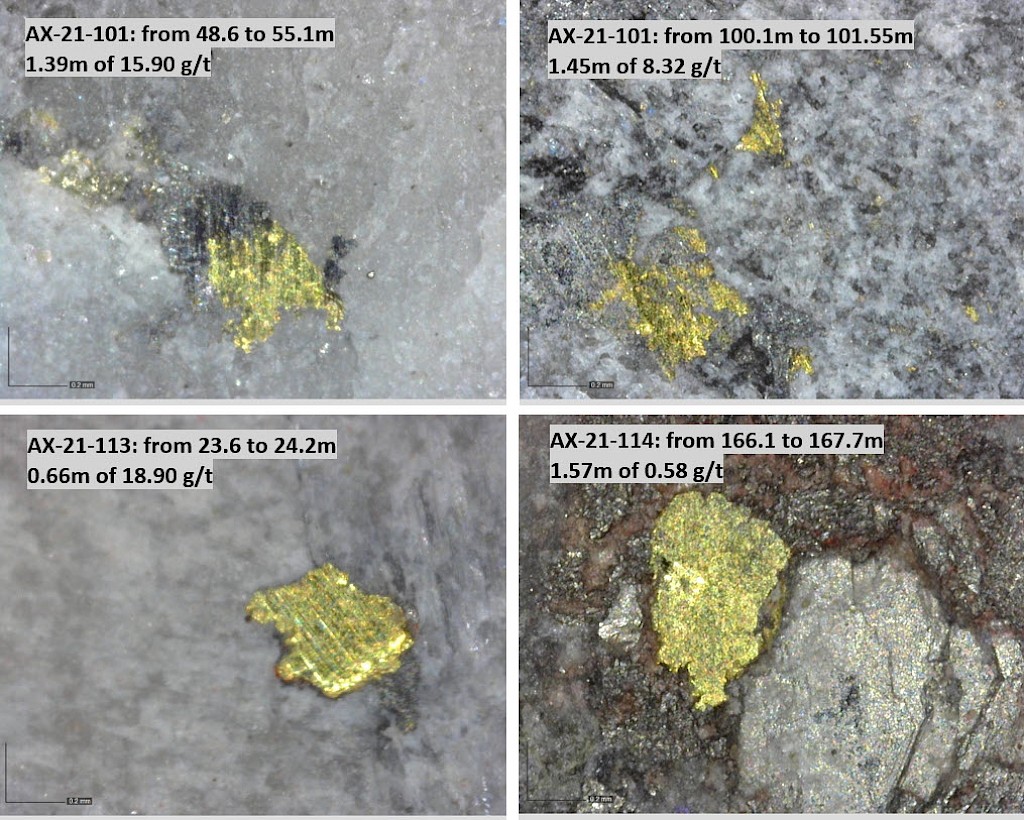
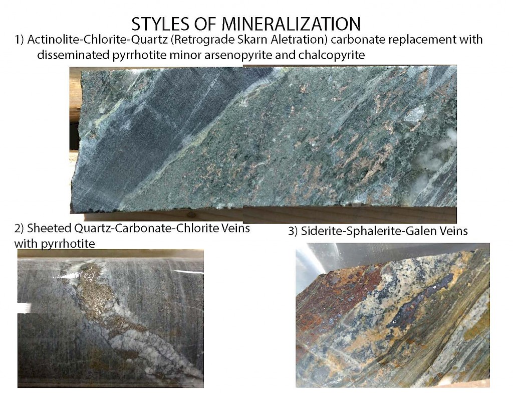
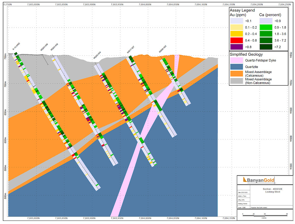
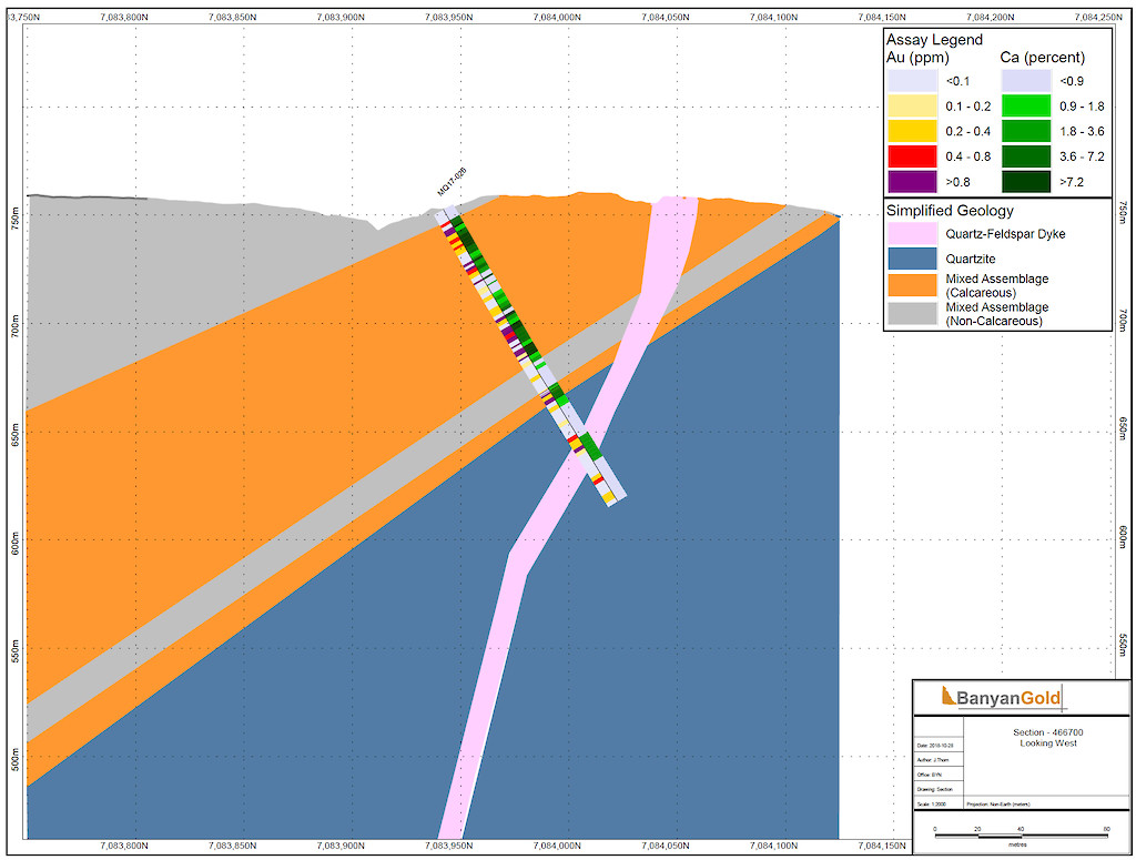
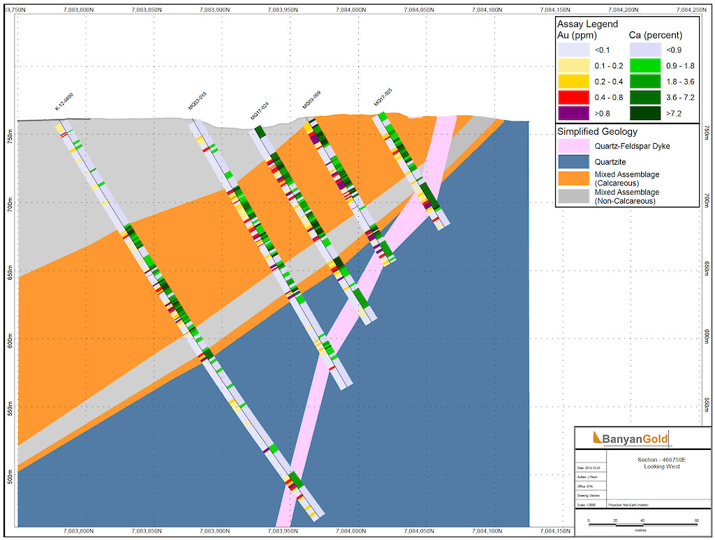
The AurMac Project hosts multiple styles of gold mineralization interpreted as intrusion-related carbonate-replacement skarns and sheeted veins.
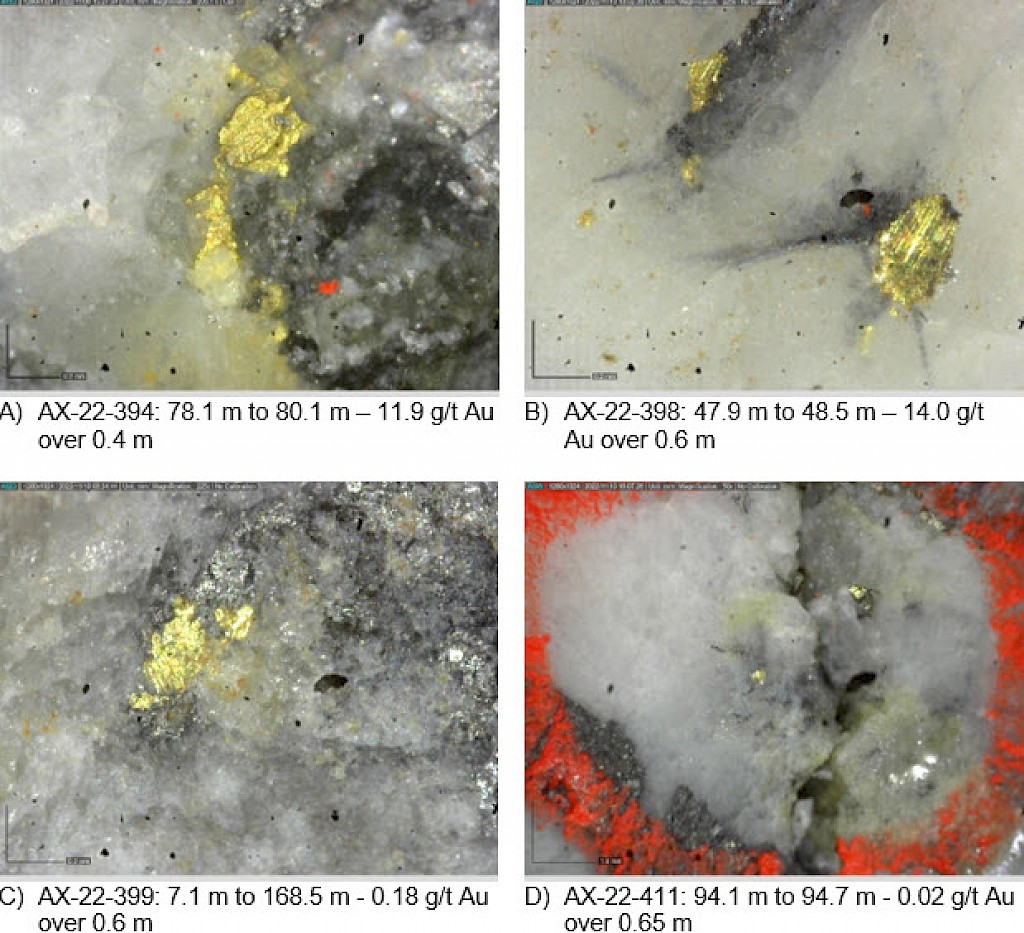
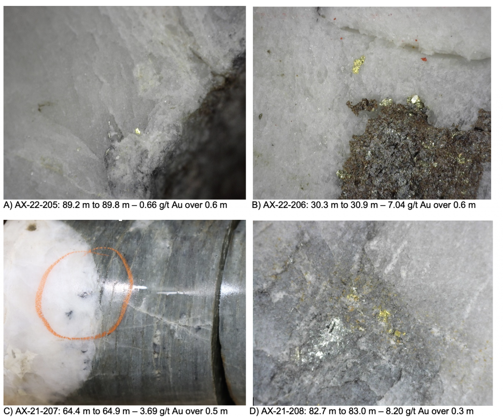
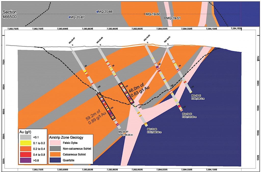
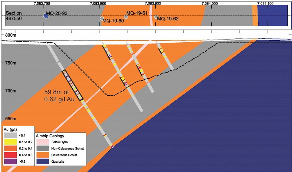
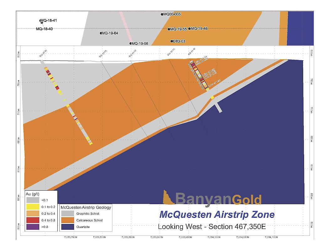
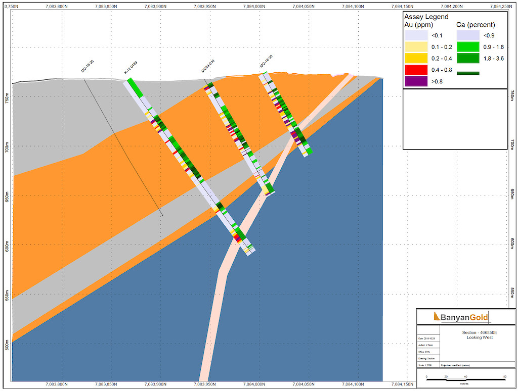
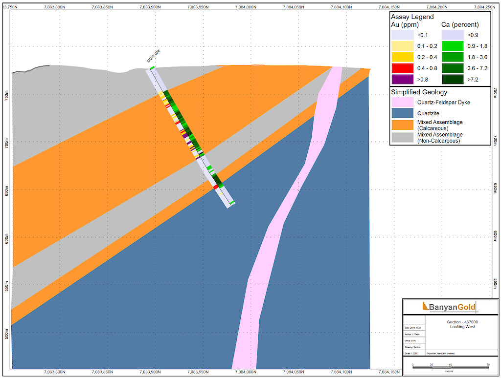
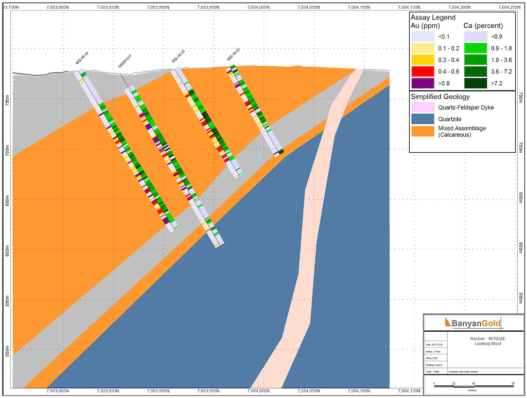
The Airstrip Zone, along the northern extent of the property, has undergone at least three stages of mineralization consisting of early gold-bearing calc – silicate – pyrrhotite skarns and multi-stage, quartz – arsenopyrite – pyrrhotite veins. Skarns commonly develop proximal to the margins of felsic dykes and have anomalous bismuth ± tungsten, antimony, and copper suggesting proximity to an extensive intrusive source. The gold-bearing quartz – arsenopyrite – pyrrhotite veins are more common in the competent Keno Hill Quartzites and occur as veins, lenses, or as vein faults in the local dilatant and fracture zones. The principal ore minerals are pyrite, arsenopyrite, and gold that generally accompanies arsenopyrite. Later, ‘Keno Hill style’ quartz and siderite veins with pyrite, galena, and sphalerite that make up the principal economic deposits of the nearby Keno Hill area, are interpreted as the last stage of mineralization.
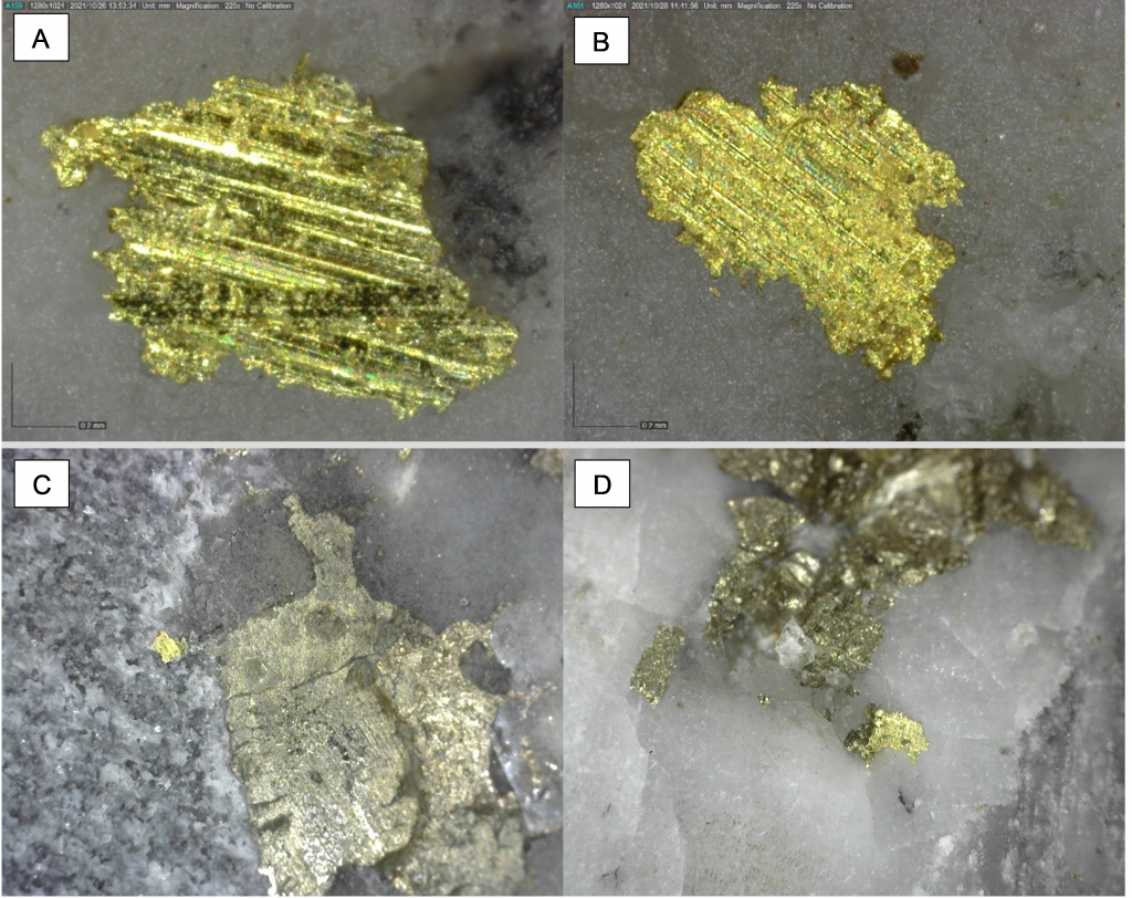
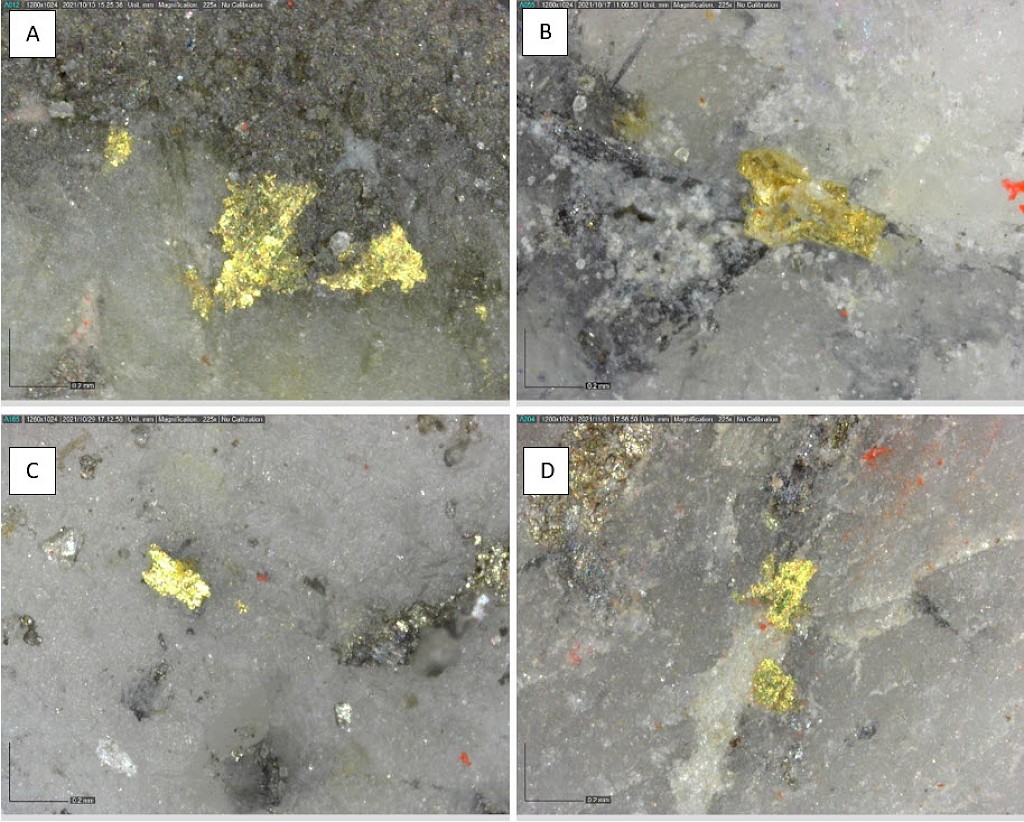
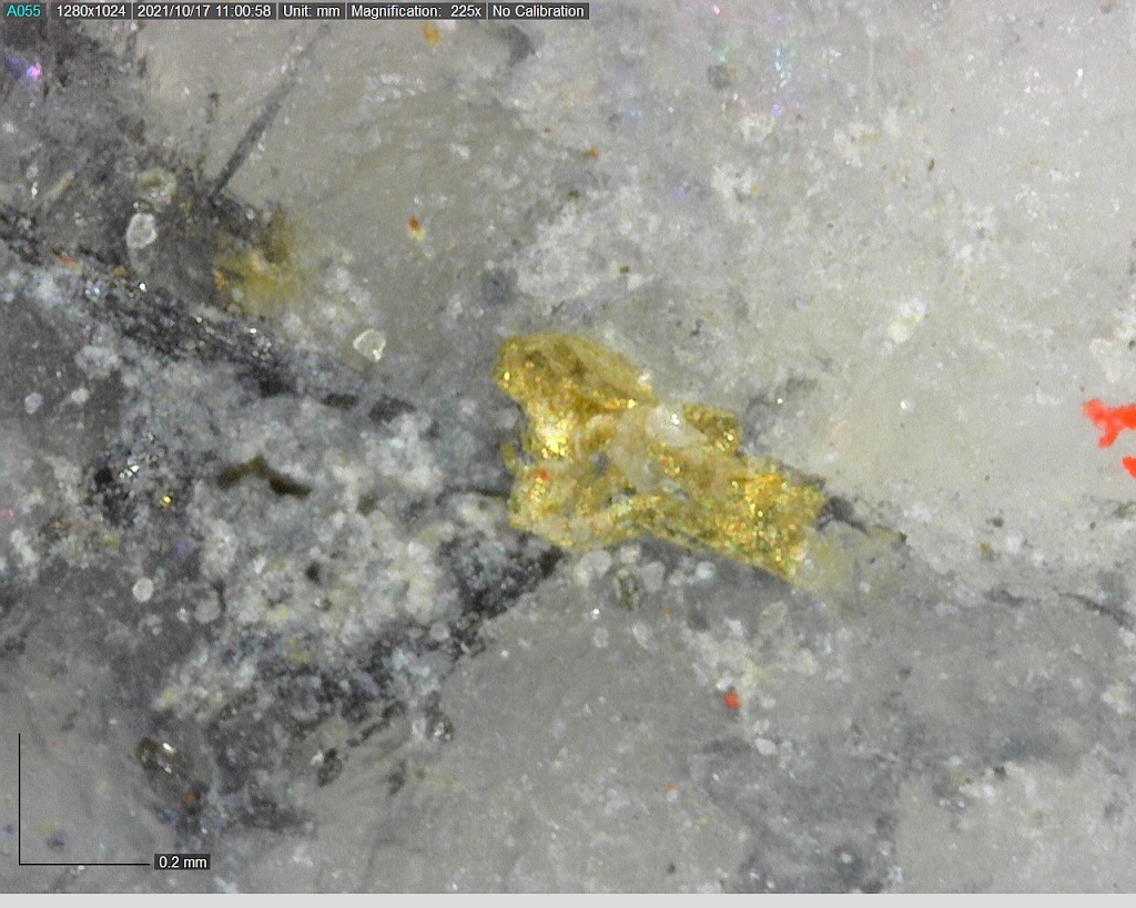
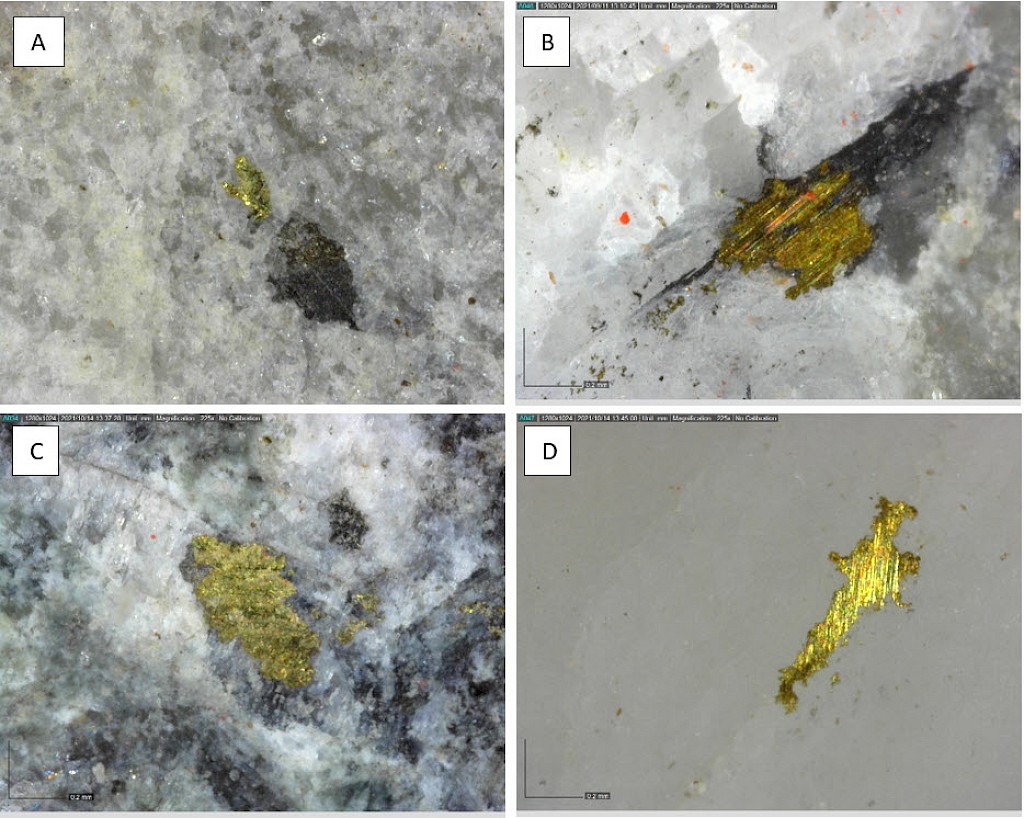
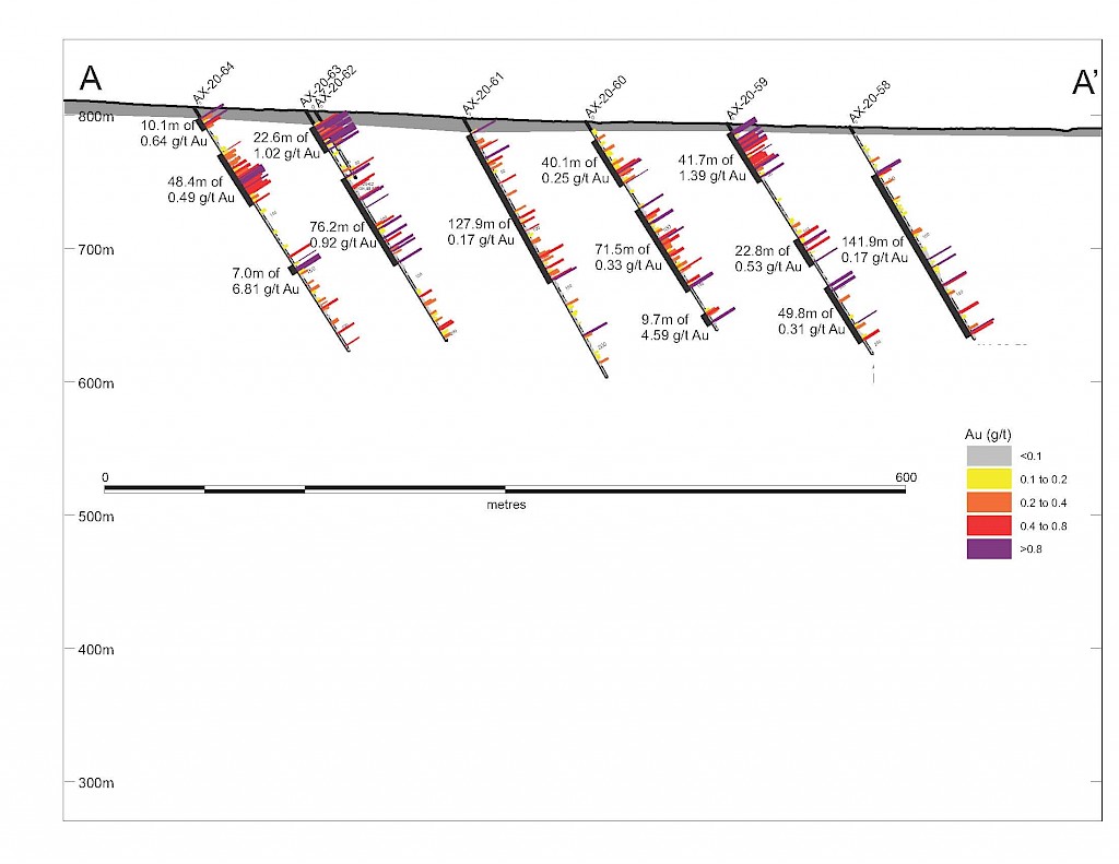
Within the Powerline Zone (south of Airstrip) and the more easterly Aurex Hill Zone, gold mineralization is hosted within sheeted quartz ± carbonate veins and lesser carbonate-replacement pyrrhotite-rich horizons similar to those in the Airstrip Zone. Principal ore minerals in the gold-bearing sheeted veins are arsenopyrite – pyrite – pyrrhotite – Bi-sulphosalts and visible gold which is commonly intergrown with Bi-sulphosalts. Structurally, sheeted vein orientations are consistent through both zones dipping shallowly to the north. Limestones and calcareous metasediments are less common than at Airstrip but have similar skarn-like replacement mineralization hosting semi-massive gold-bearing pyrrhotite horizons. Late-stage ‘Keno Hill style’ quartz and siderite veins with pyrite, galena, and sphalerite, which make up the principal economic deposits of the nearby Keno Hill area, also occur locally in the Powerline Zone.
In summary mineralization occurs as:
Mineralization at the AurMac Project includes both intrusion-related gold assemblages and Keno Hill silver – base metal veins. Multiple zones have been delineated with both distinct and shared mineralization styles.
Within the Airstrip Zone, gold mineralization appears to be associated with intrusive dikes crosscutting pyrrhotite skarn altered sediments that lie above the lower quartzite. Gold mineralization within the Powerline and Aurex Hill zones is hosted within shallowly dipping sheeted veins hosting arsenopyrite – pyrite – Bi-sulphosalts along with lesser pyrrhotite-altered calcareous horizons like that in Airstrip.